Category:Maps of Sado, Niigata
Jump to navigation
Jump to search
日本語: 新潟県佐渡市の地図
Wikimedia category | |||||
| Upload media | |||||
| Instance of | |||||
|---|---|---|---|---|---|
| Category combines topics | |||||
| Sado | |||||
city in Niigata Prefecture, Japan | |||||
| Instance of | |||||
| Location | Niigata Prefecture, Japan | ||||
| Located in or next to body of water | |||||
| Legal form |
| ||||
| Inception |
| ||||
| Population |
| ||||
| Area |
| ||||
| Replaces |
| ||||
| official website | |||||
 | |||||
Media in category "Maps of Sado, Niigata"
The following 31 files are in this category, out of 31 total.
-
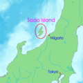
Location of Sado In The Sea of Japan.jpg 400 × 400; 19 KB
-
Sado in Niigata Prefecture Ja.svg 509 × 515; 10 KB
-
Sado in Niigata Prefecture.png 1,381 × 901; 47 KB
-
Admiralty Chart No 3003 Ando Zaki to Otose Zaki, Published 1899.jpg 11,116 × 17,058; 58.04 MB
-
Aikawa town.PNG 405 × 326; 8 KB
-
Akadomari village.PNG 405 × 326; 8 KB
-
Amalgamation Sado jp.svg 582 × 990; 120 KB
-
Hamochi town.PNG 405 × 326; 8 KB
-
Hatano town.PNG 405 × 326; 8 KB
-
Kanai town.PNG 405 × 326; 8 KB
-
Location-of-Sadogashima-island-en.png 400 × 400; 14 KB
-
Location-of-Sadogashima-island-ja.png 400 × 400; 15 KB
-
Location-of-Sadogashima-island-ko.png 400 × 400; 13 KB
-
Mano town.PNG 405 × 326; 8 KB
-
Map of Sado Island.png 352 × 497; 66 KB
-
MapSado.png 3,240 × 3,240; 16.34 MB
-
Niibo village.PNG 405 × 326; 8 KB
-
Ogi town.PNG 405 × 326; 8 KB
-
Ryoutsu city.PNG 405 × 326; 8 KB
-
Sado city.PNG 405 × 326; 8 KB
-
Sado District.png 405 × 325; 8 KB
-
Sado-map.png 515 × 819; 94 KB
-
Sado-mapa.png 515 × 819; 95 KB
-
Sadogashima Island Relief Map, SRTM-1.jpg 1,200 × 2,000; 885 KB
-
SadoIsland map.png 1,191 × 1,683; 336 KB
-
Sadoisland map.svg 744 × 1,052; 89 KB
-
Sawata town.PNG 405 × 326; 8 KB
-
Shadow picture of Sado city.svg 399 × 729; 975 KB
-
地図-新潟県羽茂郡.png 405 × 325; 7 KB
-
地図-新潟県賀茂郡.png 405 × 325; 7 KB
-
地図-新潟県雑太郡.png 405 × 325; 7 KB


