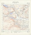
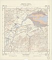
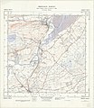
Category:Maps of Ross and Cromarty
Jump to navigation
Jump to search
Media in category "Maps of Ross and Cromarty"
The following 21 files are in this category, out of 21 total.
-
Highland UK parish map showing Tarbat parish.svg 1,320 × 1,424; 3.35 MB
-
Map of Tarbat Parish 1878 County boundaries.jpg 1,000 × 774; 292 KB
-
Ordnance Survey One-Inch Sheet 22 Dornoch, Published 1958.jpg 8,229 × 9,867; 8.55 MB
-
Ordnance Survey Sheet NC 00 10 Strath Kanaird, Published 1973.jpg 15,749 × 7,424; 48.47 MB
-
Ordnance Survey Sheet NG 78 Melvaig, Published 1971.jpg 9,280 × 6,958; 13.14 MB
-
Ordnance Survey Sheet NH 44 Aigas, Published 1950.jpg 7,588 × 8,773; 12.47 MB
-
Ordnance Survey Sheet NH 45 Marybank, Published 1962.jpg 7,648 × 8,699; 14.03 MB
-
Ordnance Survey Sheet NH 54 Beauly, Published 1950.jpg 7,652 × 8,788; 13.73 MB
-
Ordnance Survey Sheet NH 55 Dingwall, Published 1962.jpg 7,648 × 8,805; 13.41 MB
-
Ordnance Survey Sheet NH 56 Ardullie, Published 1963.jpg 7,624 × 8,789; 12.92 MB
-
Ordnance Survey Sheet NH 64 Inverness, Published 1962.jpg 7,612 × 8,798; 15.12 MB
-
Ordnance Survey Sheet NH 65 (28 65) Munlochy, Published 1950.jpg 7,624 × 8,794; 13.29 MB
-
Ordnance Survey Sheet NH 75 Fortrose, Published 1961.jpg 7,592 × 8,745; 15.22 MB
-
Ross and Cromarty UK blank map.svg 1,425 × 1,400; 2.42 MB
-
Ross and Cromarty UK location map.svg 1,425 × 1,400; 3.04 MB
-
Ross and Cromarty UK relief location map.jpg 2,004 × 1,967; 795 KB
-
Ruth Strathpeffer Achterneed Rly Map 1899 edited-3.jpg 1,000 × 837; 578 KB
-
ScotlandEasterRossWesterRoss.png 731 × 717; 443 KB
-
ScotlandRossCromarty.png 2,096 × 2,348; 153 KB
-
ScotlandRossCromLieut.png 200 × 229; 29 KB


