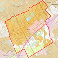
Category:Maps of Rijswijk, South Holland
Jump to navigation
Jump to search
Wikimedia category | |||||
| Upload media | |||||
| Instance of | |||||
|---|---|---|---|---|---|
| Category combines topics | |||||
| Rijswijk | |||||
city and municipality in South Holland, Netherlands | |||||
| Pronunciation audio | |||||
| Instance of | |||||
| Location | South Holland, Netherlands | ||||
| Located in or next to body of water | |||||
| Inception |
| ||||
| Population |
| ||||
| Area |
| ||||
| Elevation above sea level |
| ||||
| Different from | |||||
| official website | |||||
 | |||||
Subcategories
This category has only the following subcategory.
Media in category "Maps of Rijswijk, South Holland"
The following 16 files are in this category, out of 16 total.
-
2013-Rijswijk.jpg 1,256 × 1,353; 1.37 MB
-
BAG woonplaatsen - Gemeente Rijswijk.png 2,419 × 2,419; 664 KB
-
Gem-Rijswijk-2014Q1.jpg 2,474 × 2,684; 4.06 MB
-
Gem-Rijswijk-OpenTopo.jpg 1,959 × 2,247; 973 KB
-
Historical map of Rijswijk - Netherlands.jpg 1,384 × 1,150; 1.33 MB
-
Hoekwater polderkaart - Hoekpolder (Rijswijk).PNG 518 × 418; 527 KB
-
Hoekwater polderkaart - Nieuwe en Oude Broekpolder.PNG 540 × 470; 617 KB
-
Hoekwater polderkaart - Schaapweipolder.PNG 358 × 364; 305 KB
-
Landgoederen Rijswijk 1712.jpg 4,242 × 2,482; 3 MB
-
LocatieRijswijk.png 280 × 130; 8 KB
-
Map - NL - Municipality code 0603 (2009).svg 300 × 160; 530 KB
-
Map NL - Rijswijk - Sion.png 800 × 600; 12 KB
-
NL - locator map municipality code GM0603 (2016).png 2,125 × 1,417; 407 KB
-
Rijswijk Netherlands - Map by Colom 1647.jpg 1,575 × 1,050; 1.48 MB
-
Rijswijk ZH 1867.png 1,600 × 1,368; 191 KB
-
WijkenRijswijk.PNG 559 × 642; 16 KB


