Category:Maps of Reuss
Jump to navigation
Jump to search
Media in category "Maps of Reuss"
The following 19 files are in this category, out of 19 total.
-
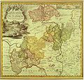
Reilly 378.jpg 1,542 × 1,374; 503 KB
-
Reuss Karte.jpg 996 × 944; 452 KB
-
Reuss1820.png 383 × 338; 8 KB
-
Fürstentümer Reuß 1894.jpg 1,165 × 1,344; 1.02 MB
-
Carte des Etats de Thuringe - Duché de Saxe-Cobourg et Gotha - 1893.jpg 5,539 × 3,910; 7.34 MB
-
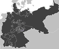
Deutsches R Reuss aeltere.png 626 × 519; 22 KB
-
Deutsches R Reuss juengere.png 626 × 519; 22 KB
-
Deutsches Reich (Karte) Reuß jüngere Linie.svg 650 × 545; 1.04 MB
-
Deutsches Reich (Karte) Reuß ältere Linie.svg 650 × 545; 1.04 MB
-
Map-DR-Reuss-Reuß ältere Linie.svg 2,621 × 2,224; 712 KB
-
R-JL.png 2,004 × 1,552; 105 KB
-
Reuss-Gera in the German Reich (1871).svg 1,425 × 1,133; 1,014 KB
-
Reuss-Greiz in the German Reich (1871).svg 1,425 × 1,133; 1,014 KB
-
ReussJLk.png 1,741 × 1,444; 66 KB
-
ReussOLk.png 1,741 × 1,444; 66 KB
-
Shield Reuss OL.png 2,004 × 1,552; 104 KB
-
VolksstaatReussKlein.png 1,002 × 776; 32 KB


