Category:Maps of Rùm
Jump to navigation
Jump to search
Media in category "Maps of Rùm"
The following 10 files are in this category, out of 10 total.
-
Harker Geological Map Isle of Rum 1903.jpg 2,405 × 2,578; 447 KB
-
Judd Geological Map Inner Hebrides 1878.jpg 2,822 × 4,745; 837 KB
-
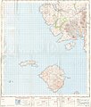
Ordnance Survey One-Inch Sheet 33 Rhum and part of Skye, Published 1957.jpg 8,263 × 9,746; 6.63 MB
-
Ordnance Survey One-Inch Sheet 34 The Cuillins, Rhum & Canna, Published 1947.jpg 8,724 × 12,904; 8.71 MB
-
Richey Geological Map Scotland Dykes.jpg 671 × 1,086; 126 KB
-
Rum - Small Isles.svg 4,370 × 2,337; 2.37 MB
-
Rum Inner Hebrides.svg 1,161 × 2,563; 4.35 MB
-
RumLandsat.jpg 831 × 872; 402 KB
-
Rùm.PNG 648 × 584; 19 KB


