Category:Maps of Quiberon
Jump to navigation
Jump to search
Wikimedia category | |||||
| Upload media | |||||
| Instance of | |||||
|---|---|---|---|---|---|
| Category combines topics | |||||
| Quiberon | |||||
commune in Morbihan, France | |||||
| Pronunciation audio | |||||
| Instance of | |||||
| Location |
| ||||
| Head of government |
| ||||
| Significant event |
| ||||
| Population |
| ||||
| Area |
| ||||
| Elevation above sea level |
| ||||
| official website | |||||
 | |||||
Media in category "Maps of Quiberon"
The following 14 files are in this category, out of 14 total.
-
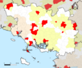
56-AAV2020-Quiberon.png 3,519 × 2,930; 1.58 MB
-
56-Quiberon-AAV2020.png 3,519 × 2,930; 436 KB
-
56186-Quiberon-Hydro.jpeg 5,846 × 4,133; 1.86 MB
-
56186-Quiberon-Routes-Hydro.png 3,507 × 2,480; 1.64 MB
-
56186-Quiberon-Sols.png 3,270 × 2,598; 1.71 MB
-
Admiralty Chart No 20 Ile d'Ouessant to St Nazaire, Published 1940.jpg 16,258 × 11,101; 59.87 MB
-
Carte de la presqu'île de Quiberon - dressée... par Ed. Blondel La Rougery - btv1b8458550j.jpg 7,978 × 10,338; 9.27 MB
-
Map commune FR insee code 56186.png 756 × 605; 45 KB
-
Map NCO Carnac programme aprem 1.jpg 1,801 × 2,138; 572 KB
-
Massif dunaire de Gâvres-Quiberon.svg 1,052 × 744; 243 KB
-
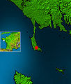
Quiberon on nasa map.jpg 267 × 314; 22 KB
-
Toponymie de Quiberon..png 9,998 × 6,720; 50.96 MB


