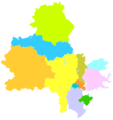
Category:Maps of Quanzhou
Jump to navigation
Jump to search
Use the appropriate category for maps showing all or a large part of Quanzhou. See subcategories for smaller areas:
| If the map shows | Category to use |
|---|---|
| Quanzhou on a recently created map | Category:Maps of Quanzhou or its subcategories |
| Quanzhou on a map created more than 70 years ago | Category:Old maps of Quanzhou or its subcategories |
| the history of Quanzhou on a recently created map | Category:Maps of the history of Quanzhou or its subcategories |
| the history of Quanzhou on a map created more than 70 years ago | Category:Old maps of the history of Quanzhou or its subcategories |
Wikimedia category | |||||
| Upload media | |||||
| Instance of | |||||
|---|---|---|---|---|---|
| Category combines topics | |||||
| Quanzhou | |||||
prefecture-level city in Fujian, China | |||||
| Instance of | |||||
| Part of |
| ||||
| Location | Fujian, PRC | ||||
| Legislative body | |||||
| Inception |
| ||||
| Population |
| ||||
| Area |
| ||||
| Elevation above sea level |
| ||||
| official website | |||||
 | |||||
Media in category "Maps of Quanzhou"
The following 14 files are in this category, out of 14 total.
-
A map of X6 bus route with Zayton bus.jpg 2,289 × 1,400; 1.62 MB
-
A route map of community bus of Zayton bus.jpg 5,704 × 3,376; 3.08 MB
-
Administrative Division Quanzhou 2.png 951 × 1,079; 111 KB
-
Administrative Division Quanzhou 3 prfc map.png 1,800 × 2,080; 260 KB
-
Administrative Division Quanzhou.png 960 × 1,020; 117 KB
-
ChinaFujianQuanzhou.png 508 × 518; 81 KB
-
Fukien 1359.png 471 × 519; 118 KB
-
Locator map Quanzhou in Fujian (claimed hatched).svg 780 × 818; 310 KB
-
Quanzhou in China.png 938 × 738; 33 KB
-
Quanzhou-map.png 800 × 903; 588 KB
-
Quanzhou.png 960 × 1,200; 219 KB
-
Quanzhoukl.png 186 × 246; 5 KB
-
安南永德革命根据地地图.png 626 × 667; 32 KB


