Category:Maps of Qajar Iran
Jump to navigation
Jump to search
Media in category "Maps of Qajar Iran"
The following 31 files are in this category, out of 31 total.
-
1907 Persia map.jpg 1,200 × 1,027; 135 KB
-
Circassiaa.jpg 500 × 400; 49 KB
-
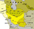
Greatest extent of the Qajar empire2.png 431 × 327; 10 KB
-
Gulistan-Treaty.jpg 1,565 × 1,200; 331 KB
-
Historical areas Armenia and Azerbaijan according to a 19th-century map by John Thomson.png 3,495 × 1,946; 10.83 MB
-
Historical Atlas of Iran - Plate No. 24.jpg 4,963 × 3,509; 2.63 MB
-
Iran 1900.jpg 1,414 × 1,276; 230 KB
-
Iran-ghajar- fathali shah.jpg 3,620 × 3,047; 2.87 MB
-
Iran-ghajar-agha mohammadkhan.jpg 3,619 × 3,038; 2.76 MB
-
Iran1916.jpg 800 × 1,139; 287 KB
-
Map Iran 1900-en.png 1,096 × 911; 352 KB
-
Map Iran 1900-fr.png 1,098 × 911; 367 KB
-
Map of North and West Africa in 1815 AD.png 7,816 × 3,960; 1.71 MB
-
Map of the Qajar Empire.png 3,196 × 1,840; 13.19 MB
-
Northwest Persia1811.jpg 1,880 × 1,508; 1.16 MB
-
Northwestern and western Iran according to a 19th-century map by John Thomson.jpg 2,068 × 4,714; 2.05 MB
-
Northwestern Iran.jpg 1,644 × 1,924; 1.38 MB
-
Northwestern part of Iran according to a 1808 map by Charles Smith.jpg 1,682 × 1,259; 432 KB
-
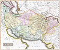
Persia 1814.jpg 2,931 × 2,448; 1.6 MB
-
Persia 1921.JPG 488 × 521; 49 KB
-
Persia afghanistan 1848.jpg 491 × 402; 116 KB
-
Persia1808.JPG 458 × 327; 63 KB
-
Persia1814.jpg 1,282 × 995; 503 KB
-
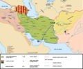
Political map of the Caucasus and its surroundings between 1795–1801.svg 4,973 × 2,735; 8.94 MB
-
Political map of the eastern part of the Southern Caucasus between 1795–1801.svg 2,669 × 1,966; 8.89 MB
-
Qajar dynasty (greatest extent).svg 553 × 553; 271 KB
-
Qajar Iran, 1797-1926.jpg 7,976 × 7,208; 7.73 MB
-
Salmas in 1814 Thomson Map of the "Persian Empire".jpg 2,931 × 2,448; 2.85 MB
-
Turkmanchai.jpg 1,565 × 1,200; 329 KB
-
گيلان ٚ شؤرائي جؤمۊري، دۊوٚؤمئ جهاني جار ٚ مئن.jpg 768 × 693; 54 KB


