Category:Maps of Qadisiyyah Province
Jump to navigation
Jump to search
Media in category "Maps of Qadisiyyah Province"
The following 15 files are in this category, out of 15 total.
-
Al-Qadisiya map.svg 1,241 × 1,264; 304 KB
-
Al-Qadisiyyah in Iraq.svg 1,241 × 1,264; 517 KB
-
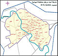
Diwaniya districts.jpg 1,593 × 1,528; 1.07 MB
-
Diwaniya.PNG 696 × 480; 272 KB
-
Empty shamiya regions.png 433 × 413; 19 KB
-
Irak locator9.svg 465 × 540; 349 KB
-
Iraq Al-Qādisiyyah Governorate.svg 1,241 × 1,264; 320 KB
-
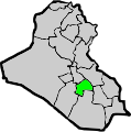
IraqAlQadisyah.png 200 × 201; 17 KB
-
Ka-dhi-shi-yaken.svg 379 × 381; 225 KB
-
Observing Freshwater Losses in the Middle East (SVS30473).pdf 1,500 × 843; 2.75 MB
-
Observing Freshwater Losses in the Middle East (SVS30473).png 4,275 × 3,375; 16.49 MB
-
Shamiya district empty.png 400 × 603; 63 KB
-
Shamiya regions.png 433 × 413; 25 KB
-
Shamiya river map.png 1,302 × 1,314; 1.22 MB
-
Shamiya.png 581 × 570; 84 KB


