Category:Maps of Protected Areas Regional Offices of Thailand
Jump to navigation
Jump to search
Media in category "Maps of Protected Areas Regional Offices of Thailand"
The following 29 files are in this category, out of 29 total.
-
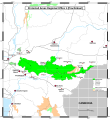
MAP of PARO 1 (Prachinburi) EN.svg 2,480 × 2,693; 194 KB
-
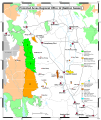
MAP of PARO 1 (Saraburi branch) EN.svg 1,843 × 2,693; 191 KB
-
MAP of PARO 1-3 EN.svg 4,394 × 5,492; 399 KB
-
MAP of PARO 10 (Udon Thani) EN.svg 2,480 × 2,693; 277 KB
-
MAP of PARO 11 (Phitsanulok) EN.svg 1,843 × 2,693; 385 KB
-
MAP of PARO 11 (Phitsanulok).svg 1,843 × 2,693; 329 KB
-
MAP of PARO 11-16 EN.svg 4,394 × 6,768; 2.72 MB
-
MAP of PARO 12 (Nakhon Sawan) EN.svg 2,268 × 2,693; 327 KB
-
MAP of PARO 13 (Lampang branch) EN.svg 1,843 × 2,268; 383 KB
-
MAP of PARO 13 (Phrae) EN.svg 2,268 × 2,764; 427 KB
-
MAP of PARO 14 (Tak) EN.svg 1,843 × 2,693; 318 KB
-
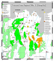
MAP of PARO 15 (Chiang Rai) EN.svg 1,843 × 2,055; 521 KB
-
MAP of PARO 16 (Chiang Mai) EN.svg 2,268 × 2,906; 491 KB
-
MAP of PARO 16 (Mae Sariang branch) EN.svg 1,843 × 2,693; 580 KB
-
MAP of PARO 2 (Si Racha) EN.svg 2,268 × 2,693; 253 KB
-
MAP of PARO 3 (Ban Pong) EN.svg 2,480 × 2,906; 315 KB
-
MAP of PARO 3 (Phetchaburi branch) EN.svg 1,843 × 2,693; 276 KB
-
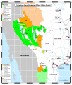
MAP of PARO 4 (Surat Thani) EN.svg 2,055 × 3,118; 595 KB
-
MAP of PARO 5 Northeast (Nakhon Si Thammarat) EN.svg 1,417 × 1,843; 206 KB
-
MAP of PARO 5 Northwest (Nakhon Si Thammarat) EN.svg 1,417 × 1,843; 298 KB
-
MAP of PARO 5 Southeast (Nakhon Si Thammarat) EN.svg 1,417 × 2,055; 278 KB
-
MAP of PARO 5 Southwest (Nakhon Si Thammarat) EN.svg 1,417 × 2,055; 336 KB
-
MAP of PARO 6 (Pattani branch) EN.svg 1,417 × 1,630; 163 KB
-
MAP of PARO 6 (Songkhla) EN.svg 1,843 × 2,268; 208 KB
-
MAP of PARO 7 (Nakhon Ratchasima) EN.svg 2,268 × 2,764; 238 KB
-
MAP of PARO 7-10 EN.svg 4,394 × 5,315; 293 KB
-
MAP of PARO 8 East (Khon Kaen) EN.svg 1,843 × 2,693; 183 KB
-
MAP of PARO 8 West (Khon Kaen) EN.svg 1,843 × 2,693; 244 KB
-
MAP of PARO 9 (Ubon Ratchathani) EN.svg 1,843 × 3,756; 283 KB


