Category:Maps of Poitou
Jump to navigation
Jump to search
Wikimedia category | |||||
| Upload media | |||||
| Instance of | |||||
|---|---|---|---|---|---|
| Category combines topics | |||||
| Poitou | |||||
historical province of France | |||||
| Instance of | |||||
| Location |
| ||||
| Capital | |||||
| Area |
| ||||
 | |||||
Subcategories
This category has the following 2 subcategories, out of 2 total.
M
- Maps of France in 1030 (11 F)
Media in category "Maps of Poitou"
The following 21 files are in this category, out of 21 total.
-
Bas-Poitou dans le Poitou.png 1,417 × 703; 96 KB
-
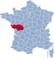
Carte du Poitou.svg 2,785 × 1,738; 677 KB
-
County of Poitiers.png 894 × 899; 23 KB
-
G. Bruno - Le Tour de la France par deux enfants p224.jpg 832 × 1,188; 215 KB
-
Kaart-Poitou.png 200 × 215; 33 KB
-
Location map of the Pays de la Loire region, France.svg 1,546 × 1,497; 906 KB
-
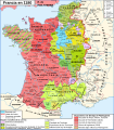
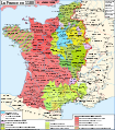
Map France 1180-br.svg 988 × 1,124; 1.9 MB
-
Map France 1180-de.svg 988 × 1,124; 1.94 MB
-
Map France 1180-es.svg 988 × 1,124; 1.97 MB
-
Map France 1180-fr.svg 988 × 1,124; 1.88 MB
-
Map France 1180-ru.svg 988 × 1,124; 1.88 MB
-
Map France 1180-uk.svg 988 × 1,124; 1.68 MB
-
Marches Bretagne Poitou-fr.svg 1,361 × 917; 107 KB
-
Marzioù Breizh Poatev.svg 1,361 × 917; 99 KB
-
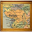
Poitou - Province.jpg 1,421 × 1,510; 1.92 MB
-
Poitou Historique.png 1,318 × 683; 331 KB
-
Poitou in France (1789).svg 2,000 × 1,922; 1.05 MB
-
Poitou province.png 894 × 899; 46 KB
-
Poitou-ru.png 537 × 430; 97 KB
-
UBBasel Map 1579 Kartenslg Mappe 233-57 Pictonum vicinarum.tiff 9,860 × 7,087, 2 pages; 399.75 MB
