Category:Maps of Pintac
Jump to navigation
Jump to search
Wikimedia category | |||||
| Upload media | |||||
| Instance of | |||||
|---|---|---|---|---|---|
| Category combines topics | |||||
| Pintac | |||||
commune in Hautes-Pyrénées, France  .svg)  | |||||
| Instance of | |||||
| Location |
| ||||
| Population |
| ||||
| Area |
| ||||
| Elevation above sea level |
| ||||
 | |||||
Subcategories
This category has the following 2 subcategories, out of 2 total.
Media in category "Maps of Pintac"
The following 7 files are in this category, out of 7 total.
-
 65364-Pintac - Localisation.png 2,000 × 2,480; 1.04 MB
-
 65364-Pintac-Cadastre.png 7,015 × 4,960; 2.17 MB
-
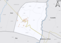
 65364-Pintac-Hydro.png 7,015 × 4,960; 1.44 MB
-
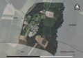 65364-Pintac-Orthophoto.png 7,015 × 4,960; 2.62 MB
-
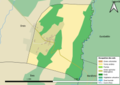 65364-Pintac-Sols.png 7,015 × 4,960; 1.59 MB
-
 Localisation de Pintac dans les Hautes-Pyrénées 1.pdf 1,754 × 2,481; 617 KB
-
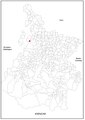
 Map commune FR insee code 65364.png 756 × 605; 21 KB


