Category:Maps of Philadelphia County, Pennsylvania
Jump to navigation
Jump to search
Wikimedia category | |||||
| Upload media | |||||
| Instance of | |||||
|---|---|---|---|---|---|
| Category combines topics |
| ||||
| Philadelphia County | |||||
county in Pennsylvania, United States | |||||
| Instance of | |||||
| Named after | |||||
| Location | Pennsylvania | ||||
| Capital | |||||
| Inception |
| ||||
| Population |
| ||||
| Area |
| ||||
| official website | |||||
 | |||||
Philadelphia County is located in southeast Pennsylvania in the United States. It is coterminous (since 1854) with the city of Philadelphia, its county seat. Philadelphia County is one of the three original counties, along with Chester and Bucks counties, created by William Penn in November 1682.
Subcategories
This category has the following 2 subcategories, out of 2 total.
P
Media in category "Maps of Philadelphia County, Pennsylvania"
The following 18 files are in this category, out of 18 total.
-
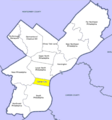
CCPhilaDistrict.PNG 536 × 575; 26 KB
-
Map of Pennsylvania highlighting Philadelphia County.svg 1,980 × 1,138; 96 KB
-
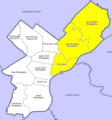
NEPhilaDistrict.PNG 536 × 575; 26 KB
-
NPhilaDistrict.PNG 536 × 575; 26 KB
-
NWPhilaDistrict.PNG 536 × 575; 26 KB
-
Phila parks.png 596 × 666; 25 KB
-
Phila parks.svg 596 × 666; 166 KB
-
Philadelphia county shaded.png 808 × 874; 178 KB
-
Philadelphia county.png 808 × 874; 178 KB
-
Philadelphia Neighborhood Map.svg 584 × 661; 92 KB
-
Philadelphia, Pennsylvania 1955 Yellow Book.jpg 800 × 700; 177 KB
-
PhilaDistrict.PNG 536 × 575; 21 KB
-
Race and ethnicity 2010- Philadelphia (5559907949).png 3,009 × 3,009; 4.78 MB
-
SPhilaDistrict.PNG 536 × 575; 26 KB
-
SWPhilaDistrict.PNG 536 × 575; 26 KB
-
WPhilaDistrict.PNG 536 × 575; 32 KB


