Category:Maps of Peoria, Illinois
Jump to navigation
Jump to search
Wikimedia category | |||||
| Upload media | |||||
| Instance of | |||||
|---|---|---|---|---|---|
| Category combines topics | |||||
| Peoria | |||||
county seat of Peoria County, Illinois, United States | |||||
| Instance of |
| ||||
| Named after | |||||
| Location | Peoria County, Illinois | ||||
| Legislative body |
| ||||
| Head of government |
| ||||
| Inception |
| ||||
| Population |
| ||||
| Area |
| ||||
| Elevation above sea level |
| ||||
| official website | |||||
 | |||||
Subcategories
This category has the following 2 subcategories, out of 2 total.
Media in category "Maps of Peoria, Illinois"
The following 15 files are in this category, out of 15 total.
-
ILMap-doton-Peoria.PNG 167 × 300; 25 KB
-
Map highlighting Peoria City Township, Peoria County, Illinois.svg 766 × 766; 251 KB
-
Map of Peoria Co., Illinois (13406910245).jpg 1,903 × 2,000; 3.94 MB
-
Map of Peoria Co., Illinois LOC 2013593079.jpg 15,300 × 16,052; 37.88 MB
-
Map of Peoria Co., Illinois LOC 2013593079.tif 15,300 × 16,052; 702.65 MB
-
Peoria IL.png 422 × 359; 4 KB
-
Peoria metropolitan area.svg 3,453 × 6,157; 87 KB
-
Peoria, Illinois 1867. LOC 73693368.jpg 10,632 × 6,796; 16.17 MB
-
Peoria, Illinois 1955 Yellow Book.jpg 800 × 921; 202 KB
-
The Commercial and financial chronicle (1909) (14766438744).jpg 2,596 × 4,278; 2.45 MB
-
The Commercial and financial chronicle (1910) (14577828339).jpg 2,540 × 4,178; 2.31 MB
-
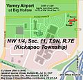
Varney at Big Hollow (Map).jpg 502 × 479; 202 KB
-
Varney at Kellar (Map).jpg 525 × 511; 253 KB


