Category:Maps of Peninsular Malaysia
Jump to navigation
Jump to search
Subcategories
This category has only the following subcategory.
S
Media in category "Maps of Peninsular Malaysia"
The following 30 files are in this category, out of 30 total.
-
Approximate location of Jah Hut.png 500 × 500; 121 KB
-
CWR Malaysia (6016953335).jpg 5,184 × 3,456; 6.87 MB
-
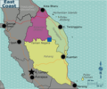
East Coast regions map.png 2,344 × 1,953; 879 KB
-
East Coast regions map.svg 750 × 625; 1.94 MB
-
Flag map of West Malaysia.png 666 × 666; 38 KB
-
Frontera Tailandia-Malasia.png 468 × 319; 8 KB
-
Jah Hut Location (2).png 445 × 476; 100 KB
-
Location map Malaysia Peninsula.png 884 × 951; 218 KB
-
Location map Peninsula Malaysia.png 539 × 656; 449 KB
-
LocationBritishMalaya.png 250 × 115; 4 KB
-
Malaisie Péninsul chinois 2010.png 1,407 × 1,382; 551 KB
-
Malaya FELDA colony map v1.svg 1,445 × 1,751; 3.37 MB
-
Malaya PBT 2020.svg 1,409 × 1,751; 2.11 MB
-
Malaysia railway map.svg 1,582 × 1,562; 1.02 MB
-
MalaysiaThailand (en).png 2,226 × 3,366; 888 KB
-
MalaysiaThailand.png 2,226 × 3,366; 894 KB
-
Map of Peninsular Malaysia with third-level administrative divisions.svg 739 × 815; 9.24 MB
-
Map PeninsularMalaysia.png 500 × 500; 36 KB
-
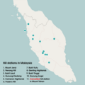
Maps of Hill Stations in Malaysia.png 2,116 × 2,116; 271 KB
-
MArco Polo's journey in India and Malay countries.jpg 2,416 × 1,459; 1.11 MB
-
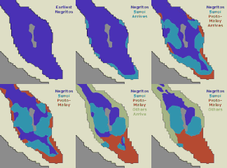
NegritoToOthers003.gif 277 × 307; 65 KB
-
Peninsular Malaysia Families Languages.png 552 × 840; 193 KB
-
Peninsular Malaysia Map WorldFactBook.png 186 × 268; 8 KB
-
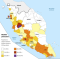
SemaiMap.png 281 × 381; 66 KB
-
Status pemetaan geologi semenanjung 2013.png 640 × 745; 307 KB
-
West Malaysia Electoral District before 2013.svg 1,585 × 1,989; 703 KB
-
West Malaysia location map.svg 400 × 457; 467 KB
-
怡保的位置.png 179 × 236; 48 KB
-
马来西亚华语影响图.png 736 × 848; 16 KB


