Category:Maps of Paris in the 1780s
Jump to navigation
Jump to search
Subcategories
This category has the following 5 subcategories, out of 5 total.
M
P
Media in category "Maps of Paris in the 1780s"
The following 45 files are in this category, out of 45 total.
-
1780 Bonne Map of the Environs of Paris, France - Geographicus - Paris-bonne-1780 (2).jpg 3,783 × 2,567; 5.93 MB
-
1780 Bonne Map of the Environs of Paris, France - Geographicus - Paris-bonne-1780.jpg 4,000 × 2,762; 2.09 MB
-
1780 Esnauts and Rapilly Case Map of Paris - Geographicus - Paris-esnautsrapilly-1780.jpg 4,986 × 3,514; 12.57 MB
-
1782 - Carte de la Prevoste et Vicomté de Paris - Open Data Hauts-de-Seine.jpg 4,120 × 3,098; 10.48 MB
-
1782 Esnauts and Rapilly Map of Paris.jpg 5,000 × 3,513; 7.61 MB
-
1785 - Environs de Paris ou se trouvt - Open Data Hauts-de-Seine.jpg 2,406 × 2,074; 941 KB
-
Plan de Paris en 1787 par Brion de la Tour.jpg 6,291 × 4,411; 9.38 MB
-
Map of Paris in 1789 by William R Shepherd (died 1834).jpg 1,123 × 947; 1.23 MB
-
Carte des environs de paris - no-nb krt 00707.jpg 10,286 × 7,190; 34.89 MB
-
Censives en 1786 dans le quartier de l'Hôtel-de-Ville.png 434 × 510; 430 KB
-
Charles de Wailly, Plan général du projet des embellissements de Paris, 1785 - Gallica.jpg 10,562 × 8,021; 17.87 MB
-
Diocèse de Paris, dedié à Monseigneur Antoine-Eléonor-Léon Le Clerc de Juigné - BHVP.jpg 4,366 × 3,359; 2.28 MB
-
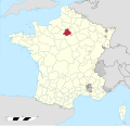
Diocèse Paris 1789.svg 2,000 × 1,922; 801 KB
-
Jean Lattré, Plan de la ville de Paris et de ses faubourgs, 1783 - Gallica.jpg 10,740 × 7,654; 17.78 MB
-
Jean Lattré, Plan routier de la ville et faubourg de Paris, 1784 (verso) - Gallica.jpg 2,358 × 1,800; 826 KB
-
Jean Lattré, Plan routier de la ville et faubourg de Paris, 1784 - Gallica.jpg 9,206 × 6,693; 16.71 MB
-
Louis-Charles Desnos, Plan de Paris divisé en six tribunaux, ca 1780 - BHVP.jpg 2,252 × 2,395; 1.18 MB
-
Nouveau plan de Paris, 1782 by Louis Brion de La Tour - Gallica.jpg 10,224 × 7,492; 17.83 MB
-
Nouveau plan de Paris, 1783 by Louis Brion de La Tour - Gallica.jpg 9,926 × 7,193; 17.62 MB
-
Nouveau plan des environs de Paris d'après les nouvelles observations... 1787 - Stanford Libraries.tif 12,472 × 8,412; 100.08 MB
-
Nouveau plan routier de la ville et fauxbourgs de Paris, 1787 - Stanford Libraries 2.jpg 12,480 × 8,662; 22.85 MB
-
Nouveau plan routier de la ville et fauxbourgs de Paris, 1787 - Stanford Libraries.jpg 12,390 × 8,651; 20.52 MB
-
Nouveau plan routier de la ville et fauxbourgs de Paris, 1787 - Stanford Libraries.tif 12,390 × 8,651; 102.25 MB
-
Plan de la ville de Paris en 1789, 1887 - Stanford Libraries.jpg 15,836 × 12,589; 71.31 MB
-
Plan de la ville de Paris en 1789, 1887 - Stanford Libraries.tif 15,836 × 12,589; 190.15 MB
-
Plan de la ville et faubourgs de Paris, 1778 - Paris Musées.jpg 15,291 × 12,073; 156.63 MB
-
Plan de Paris en 1789-1790, division administrative - Paris Musées.jpg 7,592 × 6,040; 27.71 MB
-
Plans de Paris - Plan de la ville de Paris en 1789 - Paris Musées.jpg 13,159 × 10,988; 83.17 MB
-
Plans de Paris postérieurs à 1800 - Plan de la ville de Paris en 1789 - Paris Musées.jpg 14,299 × 11,426; 91.03 MB
-
Projet de Charles de Wailly d'axe ouest-est 1789.png 913 × 387; 819 KB
-
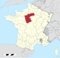
Province de Paris 1789.svg 2,000 × 1,922; 787 KB
-
SieurMichel-06.png 927 × 636; 1.05 MB
-
Vidal Lablache - Atlas General Histoire et Geographie, Paris 1789 - Hipkiss.jpg 2,953 × 4,200; 8.19 MB
-
Vidal Lablache - Atlas General Histoire et Geographie, Paris en 1789 - Hipkiss.jpg 2,688 × 2,191; 4.62 MB


