Category:Maps of Oresund
Jump to navigation
Jump to search
- English: Maps of Øresund — one of the three Danish Straits that connect the Baltic Sea to the Kattegat strait and North Sea, located in Denmark and Sweden.
Wikimedia category | |||||
| Upload media | |||||
| Instance of | |||||
|---|---|---|---|---|---|
| Category combines topics | |||||
| Øresund | |||||
strait between Denmark and Sweden | |||||
| Instance of | |||||
| Part of | |||||
| Location |
| ||||
| Inflows |
| ||||
| Different from | |||||
 | |||||
Pages in category "Maps of Oresund"
This category contains only the following page.
Media in category "Maps of Oresund"
The following 40 files are in this category, out of 40 total.
-
2017-06-05 Reiseroute einer Frachtschiffreise.jpg 557 × 557; 250 KB
-
400-kV-Cable Oerstedsvaerket Amagersvaerket Barsebaeck.png 720 × 571; 234 KB
-
Amager i Sund ubt 1 DA.png 237 × 345; 59 KB
-
Amager i Sund ubt 1 PL.png 237 × 345; 57 KB
-
Amager i Sund ubt 1.png 237 × 345; 37 KB
-
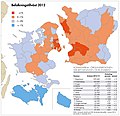
Befolkningstilvaxt Oresundsregionen 2012 (svensk text) (8620372829).jpg 4,333 × 4,200; 3.16 MB
-
Coparacy HH Route vs Øresund Bridge v2.JPG 441 × 460; 36 KB
-
Coparacy HH Route vs Øresund Bridge.JPG 448 × 475; 35 KB
-
Drogden och Flintrännan.svg 573 × 387; 56 KB
-
Flintrännan.svg 1,056 × 600; 90 KB
-
Graaen and location maps v2.jpg 461 × 362; 46 KB
-
Graaen and location maps.jpg 475 × 362; 43 KB
-
Island Graaen and Landskrona Harbour.jpg 434 × 722; 40 KB
-
Kalkgrundet.svg 1,056 × 600; 78 KB
-
Kort Oresundsmetro alternativer (10853022926).jpg 1,500 × 1,399; 332 KB
-
KøgeBugt in Øresund.jpg 237 × 344; 27 KB
-
Leuchtfeuer Aarøsund mit Sektoren.png 1,519 × 877; 469 KB
-
Locatie Sont.PNG 627 × 467; 20 KB
-
Lundåkrabukten location.jpg 237 × 344; 27 KB
-
Map of Öresund between Denmark and Sweden - no text.png 924 × 832; 203 KB
-
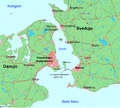
Map of Öresund between Denmark and Sweden.png 924 × 832; 205 KB
-
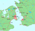
Map of Øresund new version.JPG 465 × 614; 71 KB
-
Mapo pri Sundo eo.png 924 × 832; 365 KB
-
Oresund Location Europe.png 1,600 × 1,200; 109 KB
-
Oresund Region-en.svg 377 × 291; 203 KB
-
Oresund Region-pt.svg 377 × 291; 202 KB
-
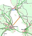
Oresund tunnel proposals.jpg 465 × 531; 82 KB
-
Oresund-blank.png 681 × 428; 34 KB
-
Oresund-de new.png 540 × 428; 37 KB
-
Oresund-it.png 680 × 428; 50 KB
-
Oresundstag nya stationer i Danmark (svensk text) grafik 20130405 1F (8620556631).jpg 4,000 × 2,481; 2.01 MB
-
Oresundstog i Danmark (dansk text) 20130405 2F (8622201282).jpg 4,000 × 2,480; 1.81 MB
-
Orientation Map HH ferry route.jpg 630 × 418; 22 KB
-
Dk-wyspy.png 413 × 341; 100 KB
-
Öresund parts.JPG 624 × 827; 83 KB
-
Øresund incl HH Ferry Route.JPG 703 × 715; 68 KB
-
Oresund Region-da.svg 377 × 291; 203 KB
-
Oresund Region-de.svg 755 × 583; 207 KB
-
Oresund Region-es.svg 755 × 583; 253 KB
-
Oresund Region-sv.svg 377 × 291; 203 KB


