Category:Maps of Oradea
Jump to navigation
Jump to search
Wikimedia category | |||||
| Upload media | |||||
| Instance of | |||||
|---|---|---|---|---|---|
| Category combines topics | |||||
| Oradea | |||||
capital city of Bihor County, Transylvania, in western Romania | |||||
| Instance of |
| ||||
| Location | Bihor County, Nord-Vest | ||||
| Street address |
| ||||
| Architectural style | |||||
| Capital |
| ||||
| Head of government |
| ||||
| Inception |
| ||||
| Population |
| ||||
| Area |
| ||||
| Elevation above sea level |
| ||||
| official website | |||||
 | |||||
Media in category "Maps of Oradea"
The following 18 files are in this category, out of 18 total.
-
Oradea in Romania.png 221 × 166; 9 KB
-
Oradea in Romania 1.png 800 × 524; 245 KB
-
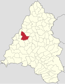
Oradea jud Bihor.png 726 × 1,000; 27 KB
-
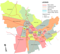
Cartiere Oradea RO.svg 5,000 × 4,500; 540 KB
-
Cartierul Ioșia Nord Oradea RO.jpg 3,748 × 3,373; 979 KB
-
Cartierul Ioșia Oradea RO.jpg 3,748 × 3,373; 977 KB
-
Cartierul Nufărul Oradea RO.jpg 3,748 × 3,373; 975 KB
-
Cartierul Olosig Oradea RO.jpg 3,748 × 3,373; 959 KB
-
Cartierul Rogerius Oradea RO.jpg 3,748 × 3,373; 976 KB
-
Cartierul Velența Oradea RO.jpg 3,748 × 3,373; 977 KB
-
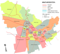
Nagyvárad Negyedek HU.svg 5,000 × 4,500; 514 KB
-
Nagyvárad utcákkal.svg 1,146 × 776; 1.59 MB
-
Oradea Citadel map RO.svg 2,600 × 2,400; 130 KB
-
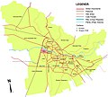
Oradea Districts EN.svg 5,000 × 4,500; 550 KB
-
Oradea Ghetto.png 1,800 × 1,800; 1.98 MB
-
Oradea jud Bihor.svg 1,180 × 1,510; 842 KB
-
Oradea metropolitan area.svg 512 × 655; 1.15 MB
-
University of Oradea Campus - map.svg 3,700 × 4,400; 228 KB
