Category:Maps of Novi Sad
Jump to navigation
Jump to search
Wikimedia category | |||||
| Upload media | |||||
| Instance of | |||||
|---|---|---|---|---|---|
| Category combines topics | |||||
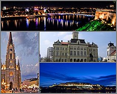
| Novi Sad | |||||
city in Serbia, capital of the state of Vojvodina | |||||
| Pronunciation audio | |||||
| Instance of |
| ||||
| Location |
| ||||
| Located in or next to body of water | |||||
| Inception |
| ||||
| Population |
| ||||
| Area |
| ||||
| Elevation above sea level |
| ||||
| official website | |||||
 | |||||
Subcategories
This category has the following 2 subcategories, out of 2 total.
M
- Maps of Petrovaradin (20 F)
Media in category "Maps of Novi Sad"
The following 38 files are in this category, out of 38 total.
-
Location map Novi Sad.jpg 3,804 × 2,344; 4.79 MB
-
Map of Bistrica (Novo Naselje) and Satelit 2010.png 1,430 × 1,101; 410 KB
-
Mapa položaja Novi Sad.svg 1,185 × 1,341; 2.56 MB
-
Novi Sad - plan iz 1929.jpg 6,600 × 8,676; 14.58 MB
-
Novi Sad BV042104340.jpg 9,665 × 7,395; 9.89 MB
-
Novi Sad in Serbia and Europe.png 900 × 540; 352 KB
-
Novi sad02 mun.png 920 × 667; 56 KB
-
Novi Sad map.gif 920 × 667; 26 KB
-
Novi Sad mun.png 920 × 753; 67 KB
-
Novi Sad mun02.png 920 × 753; 56 KB
-
Novi sad08 mun.png 920 × 667; 51 KB
-
Novi sad mz.png 1,900 × 2,150; 397 KB
-
Novi sad quarters.png 1,800 × 2,185; 1.18 MB
-
Novi sad quarters adamovicevo naselje.png 1,800 × 2,061; 1,022 KB
-
Avijacija.JPG 1,800 × 2,097; 284 KB
-
Novi sad quarters depresija.jpg 1,800 × 2,097; 283 KB
-
NS limani.JPG 1,800 × 2,097; 286 KB
-
Novonaselje map.JPG 1,800 × 2,097; 286 KB
-
NS rotkvarija.PNG 1,800 × 2,097; 1.16 MB
-
Quartiers de Novi Sad - Sremska Kamenica.png 1,800 × 2,097; 1.16 MB
-
Veternicka rampa.JPG 1,800 × 2,097; 284 KB
-
NoviSad pos.png 400 × 471; 40 KB
-
NoviSad Sat.png 1,024 × 702; 1.12 MB
-
NoviSadMunicipality.PNG 675 × 511; 49 KB
-
CityNoviSad-map01.PNG 1,568 × 1,243; 75 KB
-
City of Novi Sad 1.PNG 1,568 × 1,243; 68 KB
-
SuburbsNoviSadMap.PNG 1,568 × 1,243; 85 KB
-
NoviSad map.png 1,568 × 1,243; 63 KB
-
Suburbs of Novi Sad labelled map.png 300 × 238; 31 KB
-
Begec map.PNG 1,568 × 1,243; 76 KB
-
Budisava map.PNG 1,568 × 1,243; 64 KB
-
Bukovac map.PNG 1,568 × 1,243; 64 KB
-
Stepanovicevo map.PNG 1,568 × 1,243; 75 KB
-
Veternik map.PNG 1,568 × 1,243; 76 KB
-
Petrovaradin mun.png 666 × 752; 33 KB
-
Projekt Nostram.svg 704 × 461; 306 KB
-
Serbia Novi Sad.png 400 × 565; 24 KB
-
Светојованска порта са гробљем на плану града Новог Сада из 190? год.jpg 1,606 × 1,214; 539 KB


