Category:Maps of Norrbotten County
Jump to navigation
Jump to search
Wikimedia category | |||||
| Upload media | |||||
| Instance of | |||||
|---|---|---|---|---|---|
| Category combines topics | |||||
| Norrbotten County | |||||
county (län) in Sweden | |||||
| Instance of | |||||
| Location | Sweden | ||||
| Capital | |||||
| Official language | |||||
| Head of government |
| ||||
| Inception |
| ||||
| Highest point | |||||
| Population |
| ||||
| Area |
| ||||
| Elevation above sea level |
| ||||
| Different from | |||||
| official website | |||||
 | |||||
Subcategories
This category has the following 5 subcategories, out of 5 total.
L
M
O
Media in category "Maps of Norrbotten County"
The following 24 files are in this category, out of 24 total.
-
Norrbotten County.png 432 × 437; 6 KB
-
Svcmap norrbotten.png 192 × 400; 9 KB
-
SverigesLän2007Norrbotten.svg 287 × 606; 74 KB
-
728, 729 Piteå (Pitholmen).jpg 3,200 × 3,394; 1.83 MB
-
BD1952.png 774 × 852; 25 KB
-
BD1952text.png 774 × 852; 29 KB
-
Karta över Västerbotten och Svenska Lappmarken 1796.jpg 3,000 × 2,700; 5.21 MB
-
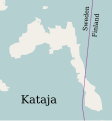
Kataja-en.svg 1,134 × 1,220; 31 KB
-
Laponia-Karte.png 1,719 × 1,263; 2.66 MB
-
Map Haparanda Skärgård National Park.png 998 × 917; 234 KB
-
Nasaleden.png 800 × 551; 16 KB
-
Norrbotten 100.png 826 × 1,168; 1.83 MB
-
Norrbotten County - UK - Лен Норрботтен, Швеція.png 432 × 437; 6 KB
-
Norrbotten County blank map.PNG 622 × 619; 54 KB
-
Norrbotten in Sweden.png 417 × 927; 15 KB
-
Norrbotten.png 999 × 1,082; 334 KB
-
Norrbottena leanas.png 432 × 437; 7 KB
-
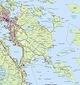
Pitholmen (Lantm, CC-webbkarta).jpg 525 × 522; 94 KB
-
Silvervägen.png 326 × 294; 16 KB
-
Struve Arc Aavasaksa.png 1,936 × 2,484; 567 KB
-
Struve Arc Tornio.png 1,936 × 2,484; 577 KB
-
The Battle of Pitea Map.png 1,920 × 1,080; 1.82 MB
-
Valkrets norrbotn lndsting.png 432 × 437; 12 KB
-
Västerbottens län och svenska lappmarken 1796.svg 2,683 × 2,489; 578 KB

