Category:Maps of Nicosia
Jump to navigation
Jump to search
Wikimedia category | |||||
| Upload media | |||||
| Instance of | |||||
|---|---|---|---|---|---|
| Category combines topics | |||||
| Nicosia | |||||
Capital of Cyprus and Northern Cyprus (de facto) | |||||
| Instance of |
| ||||
| Part of | |||||
| Location | Nicosia District, Cyprus | ||||
| Located in or next to body of water | |||||
| Population |
| ||||
| Area |
| ||||
| Elevation above sea level |
| ||||
| Different from | |||||
| Said to be the same as | Ledra | ||||
| official website | |||||
 | |||||
Media in category "Maps of Nicosia"
The following 21 files are in this category, out of 21 total.
-
Nicosia by Giacomo Franco.jpg 1,241 × 716; 447 KB
-
(1878) MAP OF NICOSIA.jpg 696 × 823; 235 KB
-
Camocio, Map of Nicosia.jpg 2,685 × 2,017; 2.36 MB
-
Carte de Chypre.svg 702 × 411; 167 KB
-
Etnografski-Kitchener's map 1882.jpg 1,657 × 1,536; 813 KB
-
Iplik Bazar and Korkut Effendi map.jpg 951 × 1,659; 501 KB
-
Lefkoşa, KKTC.svg 1,155 × 859; 4.07 MB
-
Map of Cyprus.svg 650 × 360; 180 KB
-
Map of Nicosia.png 2,062 × 1,910; 2.28 MB
-
Muzei Leventis-Map of Nicosia, 1570.jpg 2,050 × 1,523; 855 KB
-
Nicosa Kitchener Map showing location of the Konak 002.png 2,535 × 1,677; 5.57 MB
-
Nicosa Kitchener Map showing location of the Konak.png 2,736 × 1,658; 6.26 MB
-
Nicosia boundary extensions.png 1,682 × 793; 142 KB
-
Nicosia local government units.png 749 × 760; 258 KB
-
Nicosia Map.png 450 × 320; 7 KB
-
Nicosia Tannery Location.png 705 × 467; 770 KB
-
Nicosie - Peeters Jacob - 1690.jpg 1,500 × 1,124; 1.01 MB
-
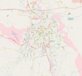
North Nicosia location map.png 768 × 512; 260 KB
-
Site of Nebethane Mesjid, Nicosia.jpg 1,229 × 1,393; 567 KB
-
Venitian Nicosia.jpg 1,000 × 577; 147 KB
-
Walled Old City, Nicosia, Cyprus.svg 655 × 663; 2.98 MB


