Category:Maps of New Providence
Jump to navigation
Jump to search
Media in category "Maps of New Providence"
The following 20 files are in this category, out of 20 total.
-
1788 Plan of the Harbour and Town of Nassau.jpg 5,876 × 2,669; 7.47 MB
-
1814 Plan of the Harbour and Town of Nassau.jpg 1,938 × 1,054; 1.13 MB
-
A plan of the harbour of New Providence - btv1b531036017.jpg 5,478 × 4,027; 2.61 MB
-
A plan of the harbour of New Providence - btv1b53103602p.jpg 4,910 × 3,521; 1.88 MB
-
A plan of the harbour of New Providence - btv1b53103604k.jpg 5,170 × 3,741; 2.35 MB
-
Admiralty Chart No 1489 New Providence, 1843, Large Corrections 1940.jpg 16,438 × 11,256; 18.4 MB
-
Election Results New Providence Bahamas 2012.jpg 1,622 × 693; 94 KB
-
Hog Island 1779 map.jpg 2,752 × 1,207; 256 KB
-
Island of New Providence one of the Bahama Islands in the West Indies.png 1,690 × 1,456; 2.33 MB
-
Nassau old town inset cropped from Bahamas 1901 Edward Stanford Atlas map.jpg 2,951 × 1,791; 809 KB
-
New Providence 1751 map.jpg 4,252 × 2,056; 1.36 MB
-
New Providence 1914 map.jpg 1,300 × 925; 245 KB
-
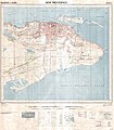
New Providence East 1962 25k topo map G 4982 N4 25 1962- Sheet2.jpg 8,554 × 9,765; 21.06 MB
-
New Providence Island inset - cropped from Bahamas 1901 Edward Stanford Atlas map.jpg 4,436 × 2,370; 1.4 MB
-
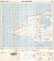
New Providence West 1962 25k topo map G 4982 N4 25 1962- Sheet1.jpg 8,562 × 9,791; 19.7 MB
-
NewProvidence2021OSM.png 7,777 × 3,141; 10.82 MB
-
NewProvidenceIsland1803 NPIonly.png 120 × 81; 25 KB
-
Newprovidencenasa.jpg 1,640 × 764; 981 KB
-
Providence.JPG 2,143 × 1,199; 772 KB
-
The Bahama Islands (1905) (19730641514).jpg 3,312 × 1,484; 747 KB


