Category:Maps of Natal Colony
Jump to navigation
Jump to search
Media in category "Maps of Natal Colony"
The following 39 files are in this category, out of 39 total.
-
115 of 'Campaigning in South Africa and Egypt' (11236739385).jpg 2,592 × 3,286; 1.47 MB
-
(1850) Scetch Map of the Natal Colony (compiled from scetches by Dr. Stranger).jpg 2,386 × 1,743; 2.78 MB
-
Map of the Colony of Natal, South Africa.jpg 2,324 × 3,023; 3.27 MB
-
Plan of Port Natal.jpg 1,323 × 1,934; 630 KB
-
1895 political map of South Africa, from the Castle Line Atlas 90.jpg 3,084 × 1,992; 784 KB
-
Battle of Colenso Map.png 546 × 621; 66 KB
-
BattleOfColenso ViljoenBJ.png 2,085 × 1,347; 5.52 MB
-
BattleOfMonteChristo ViljoenBJ.png 1,327 × 2,079; 4.92 MB
-
BattleOfNicholsonsNek ViljoenBJ.png 1,399 × 2,118; 5.8 MB
-
BattleOfPietersHill ViljoenBJ.png 2,079 × 1,367; 5.44 MB
-
BattleOfSpioenKop ViljoenBJ.png 2,059 × 1,380; 5.32 MB
-
BattleOfVaalkrantz ViljoenBJ.png 2,079 × 1,367; 5.28 MB
-
Cassier's magazine (1904) (14582237608).jpg 2,088 × 2,856; 1.23 MB
-
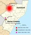
Map Langalibalele.svg 663 × 754; 2.19 MB
-
Natal 1910 BomannMuseum@20150903.JPG 3,011 × 3,916; 7.88 MB
-
Natal Colony map.png 1,000 × 827; 49 KB
-
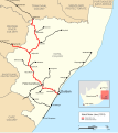
Natal main line 1910.svg 730 × 822; 592 KB
-
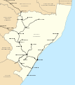
Natal railways map 1910.svg 730 × 822; 79 KB
-
NatalMap1910.svg 1,000 × 827; 57 KB
-
NatalProvinceDistricts.png 1,748 × 1,992; 85 KB
-
NGR railways map final.svg 730 × 822; 79 KB
-
NorthNatalWarTheatre, colour, crop.png 730 × 1,006; 90 KB
-
NorthNatalWarTheatre, colour.png 800 × 1,155; 78 KB
-
NorthNatalWarTheatre.png 800 × 1,155; 94 KB
-
RepubliekNatalia.png 887 × 746; 46 KB
-
Revolta de Bambata.png 2,092 × 2,092; 307 KB
-
South Africa and the Transvaal War (1900) (14579856087).jpg 1,678 × 2,770; 757 KB
-
Southern Africa Comprising Cape Colony, Natal, & c. by Keith Johnston, F.R.S.E.jpg 6,261 × 3,966; 21.25 MB
-
The Cape Colony - 1878.jpg 1,987 × 1,606; 1.02 MB


