Category:Maps of Nantes
Jump to navigation
Jump to search
Wikimedia category | |||||
| Upload media | |||||
| Instance of | |||||
|---|---|---|---|---|---|
| Category combines topics | |||||
| Nantes | |||||
city in Loire-Atlantique, Pays de la Loire, France | |||||
| Instance of | |||||
| Location |
| ||||
| Located in or next to body of water | |||||
| Head of government |
| ||||
| Headquarters location |
| ||||
| Significant event |
| ||||
| Population |
| ||||
| Area |
| ||||
| Elevation above sea level |
| ||||
| Different from | |||||
| Maximum temperature record |
| ||||
| official website | |||||
 | |||||
Subcategories
This category has the following 9 subcategories, out of 9 total.
Media in category "Maps of Nantes"
The following 45 files are in this category, out of 45 total.
-
44 LOIRE-ATLANTIQUE carte grille communale densite INSEE.png 3,507 × 2,480; 2.42 MB
-
44109-Nantes-Hydro.jpeg 5,846 × 4,133; 4.92 MB
-
Admiralty Chart No 2985 La Loire St. Nazaire to Nantes, Published 1953.jpg 16,251 × 11,100; 62.49 MB
-
Aire métropolitaine Nantes SaintNazaire.png 400 × 320; 21 KB
-
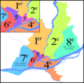
Anciens arrondissements de Nantes (centre).png 1,062 × 660; 1.27 MB
-
Anciens arrondissements de Nantes.png 1,952 × 1,924; 413 KB
-
BretagneErdreNantes.png 235 × 149; 6 KB
-
Canton de Nantes(Position).png 418 × 314; 38 KB
-
Carte - 4 intercos 29 communes.png 2,362 × 3,295; 344 KB
-
Chantenay limites communales.svg 1,222 × 1,145; 4.64 MB
-
Comblements de Nantes - Bras de l'Hôpital ouest.png 963 × 769; 1.12 MB
-
Comblements de Nantes - Bras de l'Hôpital.png 963 × 769; 1.11 MB
-
Comblements de Nantes - Bras de la Bourse.png 963 × 769; 1.12 MB
-
Comblements de Nantes - Canal Saint-Félix.png 963 × 769; 1.11 MB
-
Comblements de Nantes - Entre le pont de la Rotonde et l'île Feydeau.png 963 × 769; 1.12 MB
-
Comblements de Nantes - Erdre.png 963 × 769; 1.12 MB
-
Comblements de Nantes - Rescindement de l'île Gloriette.png 963 × 769; 1.13 MB
-
Comblements de Nantes - Schéma.png 963 × 769; 1.09 MB
-
Comblements de Nantes - Tunnel Saint-Félix.png 963 × 769; 1.13 MB
-
Deuxième circonscription de loire atlantique.jpg 657 × 594; 139 KB
-
Diocèse Nantes 1789.svg 2,000 × 1,922; 801 KB
-
FranceLoireNantes.png 100 × 97; 5 KB
-
Hôpital Saint-Jacques de Nantes - Plan.svg 913 × 474; 519 KB
-
Localisation Nantes Métropole dans la Loire-Atlantique, France.svg 742 × 637; 272 KB
-
Location Canton Nantes-11.png 602 × 522; 15 KB
-
Location Nantes.svg 400 × 320; 12 KB
-
Map commune FR insee code 44109.png 756 × 605; 158 KB
-
Map Nantes.jpg 1,980 × 2,015; 4.06 MB
-
Nantes comblements.png 1,586 × 1,474; 851 KB
-
Nantes dot.png 640 × 599; 155 KB
-
Nantes Jardin des Plantes.svg 658 × 735; 130 KB
-
Nantes OSM 01.png 541 × 547; 298 KB
-
Nantes OSM 02.png 541 × 547; 397 KB
-
Nantes WLM 2012 - parcours Artistes.png 1,100 × 850; 1.03 MB
-
Nantes WLM 2012 - parcours Cigales.png 1,100 × 850; 1.16 MB
-
Nantes WLM 2012 - parcours Petits Nicolas.png 1,100 × 850; 1.14 MB
-
Nc2.png 587 × 323; 41 KB
-
Periph-Nantes.png 474 × 573; 31 KB
-
Plannantes-1-.gif 466 × 502; 7 KB
-
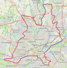
Quartiers de Nantes.png 465 × 471; 70 KB
-
Ressort de la CAA de Nantes.PNG 526 × 556; 22 KB
-
Sevre Nantaise.jpg 591 × 468; 34 KB
-
Sites Dubigeon.png 2,933 × 1,624; 244 KB
-
Unité urbaine et aire urbaine de Nantes.svg 696 × 613; 1.08 MB
-
南特街区地图.png 667 × 649; 49 KB
