Category:Maps of Muret (Haute-Garonne)
Jump to navigation
Jump to search
Subcategories
This category has the following 2 subcategories, out of 2 total.
B
- Battle of Muret - maps (9 F)
O
- Old maps of Muret (36 F)
Media in category "Maps of Muret (Haute-Garonne)"
The following 9 files are in this category, out of 9 total.
-
31 HAUTE-GARONNE carte grille communale densite INSEE.png 3,507 × 2,480; 4.52 MB
-
31395-Muret-argile.jpg 3,057 × 2,480; 723 KB
-
31395-Muret-Natura2000.png 7,015 × 4,960; 18.1 MB
-
31395-Muret-Sols.png 7,015 × 4,960; 13.63 MB
-
31395-Muret-ZNIEFF1.png 3,519 × 2,480; 4.03 MB
-
31395-Muret-ZNIEFF2.png 3,519 × 2,480; 7.04 MB
-
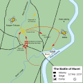
Battle of Muret Map - en.svg 746 × 746; 55 KB
-
Map commune FR insee code 31395.png 756 × 605; 117 KB
-
Muret 1213.jpg 711 × 556; 88 KB


