Category:Maps of Munich Airport
Jump to navigation
Jump to search
Wikimedia category | |||||
| Upload media | |||||
| Instance of | |||||
|---|---|---|---|---|---|
| Category combines topics | |||||
| Munich Airport | |||||
international airport serving Munich, capital of Bavaria | |||||
| Instance of |
| ||||
| Named after | |||||
| Location | |||||
| Operator |
| ||||
| Has part(s) | |||||
| Inception |
| ||||
| Date of official opening |
| ||||
| Area |
| ||||
| Elevation above sea level |
| ||||
| Interchange station | |||||
| Replaces | |||||
| IATA airport code |
| ||||
| ICAO airport code |
| ||||
| official website | |||||
 | |||||
Media in category "Maps of Munich Airport"
The following 16 files are in this category, out of 16 total.
-
Airport munich diagram de.png 1,760 × 900; 83 KB
-
Erding Ring Closure.png 848 × 694; 646 KB
-
Erdinger Ringschluss.png 848 × 694; 665 KB
-
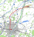
Karte Transrapid München.png 1,981 × 2,179; 1.65 MB
-
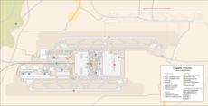
Karte vom Flughafen München (inkl. geplanter Erweiterung).png 2,644 × 1,675; 1.08 MB
-
Karte vom Flughafen München (inkl. geplanter Erweiterung).svg 2,644 × 1,675; 717 KB
-
Lageplan Flughafen München mit der 3. Startbahn.jpg 1,557 × 900; 350 KB
-
Lärmkarte Flughafen München.png 1,712 × 1,309; 846 KB
-
MUC Destinations.svg 914 × 403; 1.19 MB
-
Muenchenverkehrmitflughafen.PNG 469 × 585; 40 KB
-
München Flughafen Lage.png 800 × 800; 411 KB
-
Neufahrner spange.png 2,827 × 1,780; 1.51 MB
-
Zhs Karte vom Flughafen München (inkl. geplanter Erweiterung).png 2,644 × 1,675; 412 KB
-
Zhs München Flughafen Lage.png 800 × 800; 880 KB
-
Zht Karte vom Flughafen München (inkl. geplanter Erweiterung).png 2,644 × 1,675; 415 KB
-
Zht München Flughafen Lage.png 800 × 800; 879 KB


