Category:Maps of Mulhouse
Jump to navigation
Jump to search
Wikimedia category | |||||
| Upload media | |||||
| Instance of | |||||
|---|---|---|---|---|---|
| Category combines topics | |||||
| Mulhouse | |||||
commune in Haut-Rhin, France | |||||
| Pronunciation audio | |||||
| Instance of | |||||
| Location |
| ||||
| Located in or next to body of water | |||||
| Head of government |
| ||||
| Population |
| ||||
| Area |
| ||||
| Elevation above sea level |
| ||||
| Replaces | |||||
| official website | |||||
 | |||||
Subcategories
This category has the following 4 subcategories, out of 4 total.
Media in category "Maps of Mulhouse"
The following 37 files are in this category, out of 37 total.
-
Map commune FR insee code 68224.png 756 × 605; 93 KB
-
68-AAV2020-Mulhouse.png 3,519 × 3,197; 1.98 MB
-
68-Mulhouse-AAV2020.png 3,519 × 2,930; 2.48 MB
-
68224-Mulhouse-Hydro.jpeg 5,846 × 4,133; 4.25 MB
-
68224-Mulhouse-Sols.png 3,270 × 2,598; 8.08 MB
-
Arrondissement de Mulhouse.PNG 388 × 480; 12 KB
-
Carte des quartiers IRIS de Mulhouse.svg 733 × 740; 55 KB
-
Cartecentre villemulhouse.png 1,887 × 2,118; 1.56 MB
-
Cartemulhouse ville-centre et banlieue.png 1,957 × 2,010; 5.1 MB
-
CCIN.gif 188 × 339; 15 KB
-
CCIN.jpg 325 × 347; 82 KB
-
Centralenucleairefessenheimetagglomulhousienne.png 880 × 570; 2.61 MB
-
Foret nonnenbruch.png 1,752 × 1,688; 1.72 MB
-
Locator Mulhouse.svg 1,000 × 1,702; 130 KB
-
Map Mulhouse.jpg 1,889 × 2,032; 3.75 MB
-
Metropolerhinrhone.png 600 × 523; 942 KB
-
Michelin nr 66, 1940 Mulhouse.jpg 5,889 × 5,017; 9.87 MB
-
MuhlouseBlaue-banane.png 521 × 534; 67 KB
-
Mulhouse (Arrondissement) Plan.svg 299 × 508; 76 KB
-
Mulhouse Bourtzwiller.jpg 1,889 × 2,032; 3.57 MB
-
Mulhouse Coteaux.jpg 1,889 × 2,032; 3.59 MB
-
Mulhouse Dornach.jpg 1,889 × 2,032; 3.58 MB
-
Mulhouse economy-main areas.png 718 × 600; 880 KB
-
Mulhouse metropole sud-alsace.png 584 × 452; 212 KB
-
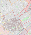
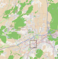
Mulhouse OSM 01.png 611 × 591; 301 KB
-
Mulhouse OSM 02.png 611 × 591; 486 KB
-
Mulhouse unite urbaine.png 520 × 458; 89 KB
-
Mulhouse-Karte.gif 1,804 × 1,689; 114 KB
-
Mulhouse-Karte.png 1,804 × 1,689; 164 KB
-
Mulhouse-Position.png 295 × 234; 23 KB
-
Mulhouselocalisationmonde.png 1,850 × 925; 477 KB
-
Musée histoire Mulhouse 169.jpg 2,048 × 1,536; 896 KB
-
Paysregmulh.jpg 681 × 500; 92 KB
-
Pentagone européen European pentagon Mulhouse.png 738 × 756; 83 KB
-
Quartiermulhouseintramuros.png 650 × 650; 120 KB
-
République Mulhouse 1789.svg 2,000 × 1,922; 797 KB
-
Wittenheim map - districts.png 2,420 × 1,544; 1.44 MB
