Category:Maps of Mpumalanga municipalities with 2011 borders
Jump to navigation
Jump to search
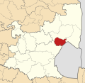
This category contains maps of municipalities in Mpumalanga province of South Africa that show the the municipal borders as they were after the municipal election of 18 May 2011. The borders of many municipalities across the country changed again in 2016.
Media in category "Maps of Mpumalanga municipalities with 2011 borders"
The following 28 files are in this category, out of 28 total.
-
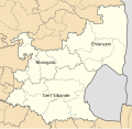 Map of Mpumalanga with districts labelled (2011).svg 768 × 746; 267 KB
-
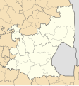
 Map of Mpumalanga with municipalities blank (2011).svg 768 × 746; 750 KB
-
 Map of Mpumalanga with Albert Luthuli highlighted (2011).svg 768 × 746; 245 KB
-
 Blank map of Mpumalanga (2011).svg 683 × 732; 274 KB
-
 Map of Mpumalanga with Bushbuckridge highlighted (2011).svg 768 × 746; 253 KB
-
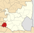
 Map of Mpumalanga with Delmas highlighted (2011).svg 768 × 746; 243 KB
-
 Map of Mpumalanga with Dipaleseng highlighted (2011).svg 768 × 746; 253 KB
-
 Map of Mpumalanga with Dr JS Moroka highlighted (2011).svg 768 × 746; 244 KB
-
 Map of Mpumalanga with Ehlanzeni highlighted (2011).svg 768 × 746; 250 KB
-
 Map of South Africa with Ehlanzeni highlighted (2011).svg 809 × 709; 478 KB
-
 Map of Mpumalanga with Emakhazeni highlighted (2011).svg 768 × 746; 246 KB
-
 Map of Mpumalanga with Emalahleni highlighted (2011).svg 768 × 746; 245 KB
-
 Map of Mpumalanga with Gert Sibande highlighted (2011).svg 768 × 746; 281 KB
-
 Map of South Africa with Gert Sibande highlighted (2011).svg 809 × 709; 485 KB
-
 Map of Mpumalanga with Govan Mbeki highlighted (2011).svg 768 × 746; 245 KB
-
 Map of Mpumalanga with Lekwa highlighted (2011).svg 768 × 746; 255 KB
-

-
 Map of Mpumalanga with Mbombela highlighted (2011).svg 768 × 746; 252 KB
-
 Map of Mpumalanga with Mkhondo highlighted (2011).svg 768 × 746; 252 KB
-
 Map of Mpumalanga with Msukaligwa highlighted (2011).svg 768 × 746; 248 KB
-
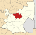
 Map of Mpumalanga with Nkangala highlighted (2011).svg 768 × 746; 256 KB
-
 Map of South Africa with Nkangala highlighted (2011).svg 809 × 709; 481 KB
-
 Map of Mpumalanga with Nkomazi highlighted (2011).svg 768 × 746; 248 KB
-
 Map of Mpumalanga with Pixley ka Seme highlighted (2011).svg 768 × 746; 256 KB
-
 Map of Mpumalanga with Steve Tshwete highlighted (2011).svg 768 × 746; 249 KB
-
 Map of Mpumalanga with Thaba Chweu highlighted (2011).svg 768 × 746; 247 KB
-
 Map of Mpumalanga with Thembisile Hani highlighted (2011).svg 768 × 746; 249 KB
-
 Map of Mpumalanga with Umjindi highlighted (2011).svg 768 × 746; 243 KB
.svg)
.svg)
.svg)
.svg)
.svg)
.svg)
.svg)
.svg)
.svg)
.svg)
.svg)
.svg)
.svg)
.svg)
.svg)
.svg)
.svg)
.svg)
.svg)
.svg)
.svg)
.svg)
.svg)
.svg)
.svg)
.svg)
.svg)
.svg)