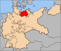
Category:Maps of Mecklenburg-Schwerin
Jump to navigation
Jump to search
Media in category "Maps of Mecklenburg-Schwerin"
The following 13 files are in this category, out of 13 total.
-
Meklenburg ducatus - CBT 5874386.jpg 5,577 × 4,301; 5.17 MB
-
Deutsches R Mecklenburg-Schwerin.png 626 × 519; 22 KB
-
Deutsches Reich (Karte) Mecklenburg-Schwerin.svg 650 × 545; 1.04 MB
-
Dobbertin-Lüschow-Goldberg (Wiebeking 1786).jpg 1,729 × 1,273; 510 KB
-
Karte-Mecklenburg.png 2,437 × 1,787; 229 KB
-
Map-WR-MeckSchwerin.svg 1,185 × 1,007; 541 KB
-
Mecklenburg-Schwerin in the German Reich (1871).svg 1,425 × 1,133; 1,014 KB
-
Mecklenburg-Schwerin in the German Reich (1925).svg 1,425 × 1,133; 967 KB
-
Mecklenburg-Schwerin und Mecklenburg-Strelitz (1908).jpg 4,243 × 3,473; 4.52 MB
-
Mecklenburg1880Andree.tif 3,913 × 2,577; 28.85 MB


