Category:Maps of McKean County, Pennsylvania (style A)
Jump to navigation
Jump to search
Media in category "Maps of McKean County, Pennsylvania (style A)"
The following 16 files are in this category, out of 16 total.
-
 Map of Pennsylvania highlighting McKean County.svg 1,980 × 1,138; 96 KB
-
 Map of Ceres Township, McKean County, Pennsylvania Highlighted.png 1,696 × 1,300; 78 KB
-
 Map of McKean County Highlighting Annin Township.PNG 782 × 599; 54 KB
-
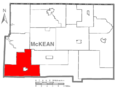
 Map of McKean County Highlighting Bradford Township.PNG 782 × 599; 54 KB
-
 Map of McKean County Highlighting Corydon Township.PNG 782 × 599; 54 KB
-
 Map of McKean County Highlighting Eldred Township.PNG 782 × 599; 54 KB
-
 Map of McKean County Highlighting Foster Township.PNG 782 × 599; 54 KB
-
 Map of McKean County Highlighting Hamilton Township.PNG 782 × 599; 55 KB
-
 Map of McKean County Highlighting Hamlin Township.PNG 782 × 599; 54 KB
-
 Map of McKean County Highlighting Keating Township.PNG 782 × 599; 55 KB
-
 Map of McKean County Highlighting Lafayette Township.PNG 782 × 599; 55 KB
-
 Map of McKean County Highlighting Liberty Township.PNG 782 × 599; 54 KB
-
 Map of McKean County Highlighting Norwich Township.PNG 782 × 599; 54 KB
-
 Map of McKean County Highlighting Otto Township.PNG 782 × 599; 54 KB
-
 Map of McKean County Highlighting Sergeant Township.PNG 782 × 599; 54 KB
-
 Map of McKean County Highlighting Wetmore Township.PNG 782 × 599; 54 KB


