Category:Maps of Marquesas Islands
Jump to navigation
Jump to search
Wikimedia category | |||||
| Upload media | |||||
| Instance of | |||||
|---|---|---|---|---|---|
| Category combines topics | |||||
| Marquesas Islands | |||||
island group in French Polynesia | |||||
| Instance of |
| ||||
| Part of | |||||
| Named after | |||||
| Location | French Polynesia | ||||
| Located in or next to body of water | |||||
| Has part(s) | |||||
| Heritage designation |
| ||||
| Highest point |
| ||||
| Population |
| ||||
| Area |
| ||||
| Elevation above sea level |
| ||||
 | |||||
Subcategories
This category has the following 5 subcategories, out of 5 total.
M
- Maps of Fatu-Hiva (12 F)
- Maps of Nuku Hiva (5 F)
- Maps of Ua-Huka (7 F)
S
Pages in category "Maps of Marquesas Islands"
This category contains only the following page.
Media in category "Maps of Marquesas Islands"
The following 30 files are in this category, out of 30 total.
-
1797 chart of Marquesas by James Wilson explorer.jpg 2,962 × 3,796; 772 KB
-
19 of 'Études coloniales. Les Colonies françaises' (11200393436).jpg 1,601 × 2,392; 974 KB
-
393 of 'Elementary Physical Geography' (11140595554).jpg 1,411 × 580; 146 KB
-
Admiralty Chart Catalogue 1967 Page 091 Index P1.jpg 8,580 × 6,834; 7.72 MB
-
Admiralty Chart No 1640 Plans in the Iles Marquises, Published 1963.jpg 16,327 × 11,278; 30.15 MB
-
Eiao map.jpg 1,240 × 904; 277 KB
-
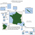
France-Constituent-Lands.png 3,337 × 3,300; 382 KB
-
France-Terres-Emergées.png 3,337 × 3,300; 299 KB
-
FrPolynes-Tahit-Marques-Gambier Map 1930.jpg 4,024 × 2,900; 10.95 MB
-
Hatutu map 513416036 14c5d4a53f o.jpg 1,240 × 904; 140 KB
-
Hiva Oa Motane Tauata 1875 map.jpg 800 × 760; 645 KB
-
Hiva-Oa.png 1,281 × 1,593; 55 KB
-
Ile-Hiva-Oa def.jpg 787 × 583; 80 KB
-
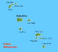
Karta FP Marquesa isl.PNG 450 × 400; 6 KB
-
Marquesas Islands-Melville 1846.png 1,269 × 1,593; 159 KB
-
Marquesas Karte.png 581 × 486; 90 KB
-
Marquesas-administrative.png 1,281 × 1,593; 64 KB
-
Marquises-administrative.png 1,281 × 1,593; 61 KB
-
MotuOne Marquesas Map.jpg 1,240 × 902; 79 KB
-
Nuku-Hiva.png 1,281 × 1,593; 55 KB
-
Pacific Ocean laea Oceanian countries map.jpg 1,165 × 1,070; 542 KB
-
Tahuata.png 1,281 × 1,593; 55 KB
-
Terihi island map.jpg 384 × 379; 66 KB
-
Ua-Pou.png 1,281 × 1,593; 55 KB


