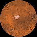
Category:Maps of Mare Australe quadrangle
Jump to navigation
Jump to search
Wikimedia category | |||||
| Upload media | |||||
| Instance of | |||||
|---|---|---|---|---|---|
| Category combines topics | |||||
| Mare Australe quadrangle | |||||
map of Mars | |||||
| Instance of |
| ||||
| Located on astronomical body | |||||
| |||||
Subcategories
This category has only the following subcategory.
Media in category "Maps of Mare Australe quadrangle"
The following 18 files are in this category, out of 18 total.
-
Agassiz Crater.jpg 1,873 × 883; 225 KB
-
Elevation of Ulyxis Rupes ESA227113.jpg 1,920 × 989; 899 KB
-
Flammarion - La planète Mars, Tome 2-f022.jpg 1,180 × 1,180; 313 KB
-
Mare Australe Map.JPG 479 × 480; 52 KB
-
Mars South Polar Layers.JPG 638 × 479; 46 KB
-
Mars Viking MDIM21 ClrMosaic 65S90S SPOLAR.jpg 2,994 × 2,994; 5.29 MB
-
Near Polar Dunes (PIA25805 fig1).png 200 × 224; 102 KB
-
PIA00190-MC-30-MareAustraleRegion-19980605.jpg 6,744 × 6,744; 3.61 MB
-
PIA02993 Mars MOLA S. polar crop.jpg 2,000 × 2,000; 2.2 MB
-
PIA09076.jpg 3,253 × 2,415; 1.73 MB
-
Promethei Planum, false-colour nadir view ESA225691.tiff 7,094 × 3,000; 32.54 MB
-
Sisyphimap2.jpg 1,348 × 533; 231 KB
-
South Polar Layers (PIA25741 fig1).png 201 × 225; 95 KB
-
South Polar Layers (PIA25755 fig1).png 201 × 225; 99 KB
-
Topography of Ultimi Scopuli ESA24652080.tiff 12,909 × 3,600; 92.16 MB
-
TopologicoPoloSurMarte.png 352 × 386; 152 KB
-
USGS-Mars-MC-30-MareAustraleRegion-mola.png 2,999 × 3,499; 8 MB
-
Wikimolasouthpole.jpg 1,909 × 847; 269 KB


