Category:Maps of Lyonnais
Jump to navigation
Jump to search
Media in category "Maps of Lyonnais"
The following 16 files are in this category, out of 16 total.
-
"Gouvernement General du Lyonnois" (21634199413).jpg 4,176 × 3,072; 2.68 MB
-
"Lionnois, Forest, Beaviolois et Masconois" (21634336003).jpg 4,158 × 3,084; 2.68 MB
-
Lionnois, Forest, Beaujolois et Masconnois - btv1b5973012q.jpg 6,241 × 4,721; 3.51 MB
-
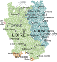
Carte du Lyonnais.svg 1,609 × 1,725; 532 KB
-
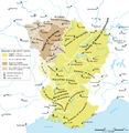
Carte-Royaume-dArles.png 1,500 × 1,529; 412 KB
-
Govvernemet de Lion - (Tassin) - btv1b8592489j.jpg 2,821 × 2,105; 1.03 MB
-
Karte Königreich Arelat DE.png 1,500 × 1,529; 414 KB
-
Lionnois, Forest, Beauiolois et Masconnois - CBT 5879709.jpg 5,566 × 4,370; 6.64 MB
-
Lyonnais - Province.jpg 2,400 × 1,350; 1.11 MB
-
Lyonnais in France (1789).svg 2,000 × 1,922; 1.05 MB
-
Lyonnais.png 891 × 899; 23 KB
-
Map Kingdom Arelat AR.png 1,454 × 1,485; 856 KB
-
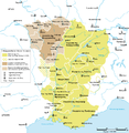
Map Kingdom Arelat EN.png 1,310 × 1,338; 209 KB
-
Map Kingdom Arelat-el.png 1,310 × 1,338; 227 KB


