Category:Maps of Lydia
Jump to navigation
Jump to search
Wikimedia category | |||||
| Upload media | |||||
| Instance of | |||||
|---|---|---|---|---|---|
| Category combines topics | |||||
| Lydia | |||||
Iron Age kingdom and then province in Asia Minor | |||||
| Instance of | |||||
| Location | Anatolia | ||||
| Capital | |||||
| Official language | |||||
| Currency | |||||
| Inception |
| ||||
| Dissolved, abolished or demolished date |
| ||||
| Different from | |||||
 | |||||
Media in category "Maps of Lydia"
The following 97 files are in this category, out of 97 total.
-
6th-century Egypt-pt.svg 1,500 × 950; 3.15 MB
-
6th-century Middle East-pt.svg 1,500 × 950; 3.13 MB
-
A Map of the Earliest Known Civilizations.jpg 2,050 × 3,042; 652 KB
-
Alter Orient 0600BC.svg 2,102 × 1,510; 4.95 MB
-
Alter Orient 0700BC.svg 2,102 × 1,510; 4.7 MB
-
Ancient Near East 0700BC.svg 2,102 × 1,510; 4.7 MB
-
Atlas Universel d'Histoire et de Géographie - Carte 7.jpg 1,579 × 1,280; 387 KB
-
AtlBalk.a-660.jpg 318 × 327; 25 KB
-
Cadusii in Media.jpg 1,600 × 1,200; 392 KB
-
Carte Lydie.png 483 × 444; 49 KB
-
Cilicia-pt.svg 575 × 390; 3.15 MB
-
Cilician-Kingdom-pt.svg 1,500 × 950; 3.13 MB
-
Cities&towns17ADquake.png 482 × 446; 416 KB
-
CNM21-Pauls3rdJourney.gif 569 × 404; 14 KB
-
Colonies of Miletus-es.svg 695 × 466; 985 KB
-
Colonies of Miletus.svg 695 × 466; 497 KB
-
Ephese regional carte.png 280 × 199; 112 KB
-
Ephesos regional map.png 1,168 × 830; 1.32 MB
-
Ephesos regional map.svg 1,170 × 832; 1.91 MB
-
Grcka kolonizacija 550 st. ere.jpg 1,200 × 902; 191 KB
-
Greek colonies 550 BC (English) (simple map).svg 1,200 × 902; 873 KB
-
Greek colonies 550 BC-hu.svg 1,200 × 902; 874 KB
-
Heinrich Kiepert. Asia citerior.Lydia.jpg 1,236 × 764; 259 KB
-
History of Art in Phrygia, Lydia, Caria and Lycia - Fig 157.png 3,174 × 2,153; 2.01 MB
-
Kingdom of Lydia.png 5,338 × 2,979; 3.12 MB
-
La Turquie en Europa by Abraham Du Bois 1714.jpg 1,600 × 1,298; 552 KB
-
LidiaRegionesDeAsiaMenor.svg 2,137 × 1,459; 2.9 MB
-
Lidija-sh.svg 459 × 448; 61 KB
-
Lydia circa 50 AD - English legend.jpg 1,653 × 1,169; 939 KB
-
Lydia circa 50 AD - Romanian legend.jpg 1,653 × 1,169; 913 KB
-
Lydia map be.svg 1,900 × 1,745; 2.46 MB
-
Lydia map ce.svg 1,900 × 1,745; 2.46 MB
-
Lydia map es.svg 1,900 × 1,745; 6.24 MB
-
Lydia map ru.svg 1,900 × 1,745; 2.47 MB
-
Lydia map uk.svg 1,900 × 1,745; 2.47 MB
-
Lydia original area of lydia.jpg 483 × 444; 76 KB
-
Lydia terjeszkedése-hu.svg 604 × 555; 234 KB
-
Lydia-he.jpg 483 × 444; 137 KB
-
Lydia-he1.jpg 483 × 444; 107 KB
-
Lydia.jpg 483 × 444; 31 KB
-
Lydia.png 2,685 × 2,232; 3.7 MB
-
Lydian Empire 600 BCE.jpg 449 × 385; 226 KB
-
Lydian kingdom-pt.svg 1,500 × 950; 3.13 MB
-
Lydian-empire-600BCE.png 250 × 115; 4 KB
-
Lydie zonder extra grens.png 1,920 × 1,330; 146 KB
-
Map of Assyria-ar.png 1,983 × 1,363; 2.37 MB
-
Map of Assyria-es.svg 2,145 × 1,474; 531 KB
-
Map of Assyria-pt.svg 2,145 × 1,474; 80 KB
-
Map of Assyria.png 1,983 × 1,363; 160 KB
-
Map of Lydia ancient times be.svg 400 × 277; 47 KB
-
Map of Lydia ancient times fa.svg 400 × 277; 105 KB
-
Map of Lydia ancient times tr.jpg 400 × 277; 13 KB
-
Map of Lydia ancient times-2.jpg 400 × 277; 30 KB
-
Map of Lydia ancient times-als.svg 400 × 277; 47 KB
-
Map of Lydia ancient times-de.svg 400 × 277; 47 KB
-
Map of Lydia ancient times-el.svg 400 × 277; 47 KB
-
Map of Lydia ancient times-en.svg 400 × 277; 47 KB
-
Map of Lydia ancient times-eo.svg 400 × 277; 47 KB
-
Map of Lydia ancient times-es.svg 868 × 600; 62 KB
-
Map of Lydia ancient times-fy.svg 400 × 277; 47 KB
-
Map of Lydia ancient times-hy.svg 400 × 277; 47 KB
-
Map of Lydia ancient times-it.svg 400 × 277; 47 KB
-
Map of Lydia ancient times-ja.svg 400 × 277; 48 KB
-
Map of Lydia ancient times-ko.svg 400 × 277; 47 KB
-
Map of Lydia ancient times-la.svg 400 × 277; 46 KB
-
Map of Lydia ancient times-nl.svg 400 × 277; 47 KB
-
Map of Lydia ancient times-pt.svg 400 × 277; 46 KB
-
Map of Lydia ancient times-ru.svg 400 × 277; 47 KB
-
Map of Lydia ancient times-zh-classical.png 400 × 277; 61 KB
-
Map of Lydia ancient times.jpg 400 × 277; 44 KB
-
Map of Lydia ancient times2-es.svg 2,137 × 1,459; 3.02 MB
-
Map of the Achaemenid Empire.jpg 1,314 × 635; 1.1 MB
-
Map of the Assyrian Empire.svg 2,145 × 1,474; 142 KB
-
Map of the Kingdom of Lydia.png 2,456 × 1,871; 961 KB
-
Map of the middle east in 650 BC.png 1,149 × 525; 47 KB
-
Median Empire ru.svg 1,500 × 950; 1.78 MB
-
Median Empire sr.svg 1,500 × 950; 1.78 MB
-
Median Empire uk.svg 1,500 × 950; 1.78 MB
-
Median Empire-ar.svg 1,500 × 950; 2.01 MB
-
Median Empire-en.svg 1,500 × 950; 1.78 MB
-
Median Empire-es.svg 1,500 × 950; 2.96 MB
-
Median Empire-hu.svg 1,500 × 950; 1.78 MB
-
Median Empire-pt.svg 1,500 × 950; 3.13 MB
-
Median Empire.jpg 1,306 × 735; 187 KB
-
Median Empire2-es.svg 1,129 × 588; 876 KB
-
Near East 600BC.svg 2,102 × 1,510; 4.93 MB
-
Oriente Medio 600 adC-pt.svg 1,249 × 693; 234 KB
-
Putz6.jpg 1,741 × 960; 498 KB
-
Putzger Kleinasien.jpg 5,385 × 3,539; 11.89 MB
-
Roman Empire Asia.svg 2,180 × 1,600; 515 KB
-
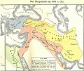
Rothert, Bd1Bl01K2 - Das Morgenland um 600 v. Chr.jpg 2,570 × 2,156; 800 KB
-
Satrapy of Lydia.jpg 855 × 505; 332 KB
-
Skythisches Reich.jpg 700 × 579; 142 KB
-
Soulier, E.; Andriveau-Goujon, J. Anciens Empires Jusqua Alexandre. 1838 (B).jpg 1,888 × 1,711; 850 KB
-
Карта Малой Азии.png 8,500 × 4,137; 3.76 MB
-
ماد و اورتا آسیا.jpg 1,429 × 1,035; 607 KB


