Category:Maps of Loire River in Indre-et-Loire
Jump to navigation
Jump to search
Subcategories
This category has the following 16 subcategories, out of 16 total.
M
- Maps of Berthenay (5 F)
- Maps of Bréhémont (5 F)
- Maps of Chouzé-sur-Loire (5 F)
- Maps of La Riche (5 F)
- Maps of Mosnes (5 F)
- Maps of Noizay (5 F)
- Maps of Pocé-sur-Cisse (5 F)
- Maps of Rigny-Ussé (5 F)
Media in category "Maps of Loire River in Indre-et-Loire"
The following 80 files are in this category, out of 80 total.
-
 37042-Candes-Saint-Martin-argile.png 3,057 × 2,480; 2.35 MB
-
 37042-Candes-Saint-Martin-Cours eau.jpg 3,507 × 2,480; 433 KB
-
 37042-Candes-Saint-Martin-Sols.png 3,270 × 2,598; 1.53 MB
-
 37074-Chouzé-sur-Loire-argile.png 3,057 × 2,480; 3.01 MB
-
 37074-Chouzé-sur-Loire-Cours eau.jpg 3,507 × 2,480; 587 KB
-
 37074-Chouzé-sur-Loire-Sols.png 3,270 × 2,598; 2.65 MB
-
 37077-Cinq-Mars-la-Pile-argile.png 3,057 × 2,480; 3.29 MB
-
 37077-Cinq-Mars-la-Pile-Cours eau.jpg 3,507 × 2,480; 660 KB
-
 37077-Cinq-Mars-la-Pile-Sols.png 3,270 × 2,598; 2.77 MB
-
 37118-Huismes-argile.png 3,057 × 2,480; 3.21 MB
-
 37118-Huismes-Cours eau.jpg 3,507 × 2,480; 580 KB
-
 37118-Huismes-Sols.png 3,270 × 2,598; 2.71 MB
-
 37123-Langeais-argile.png 3,057 × 2,480; 4.16 MB
-
 37123-Langeais-Cours eau.jpg 3,507 × 2,480; 760 KB
-
 37123-Langeais-Sols.png 3,270 × 2,598; 2.86 MB
-
 37131-Limeray-argile.png 3,057 × 2,480; 3.22 MB
-
 37131-Limeray-Cours eau.jpg 3,507 × 2,480; 625 KB
-
 37131-Limeray-Sols.png 3,270 × 2,598; 2.67 MB
-
 37138-Lussault-sur-Loire-argile.png 3,057 × 2,480; 2.07 MB
-
 37138-Lussault-sur-Loire-Cours eau.jpg 3,507 × 2,480; 415 KB
-
 37138-Lussault-sur-Loire-Sols.png 3,270 × 2,598; 1.28 MB
-
 37156-Montlouis-sur-Loire-Cours eau.jpg 3,507 × 2,480; 670 KB
-
 37156-Montlouis-sur-Loire-Sols.png 3,270 × 2,598; 3.58 MB
-
 37161-Mosnes-argile.png 3,057 × 2,480; 2.21 MB
-
 37161-Mosnes-Cours eau.jpg 3,507 × 2,480; 459 KB
-
 37161-Mosnes-Sols.png 3,270 × 2,598; 1.63 MB
-
 37163-Nazelles-Négron-argile.png 3,057 × 2,480; 3.41 MB
-
 37163-Nazelles-Négron-Cours eau.jpg 3,507 × 2,480; 666 KB
-
 37163-Nazelles-Négron-Sols.png 3,270 × 2,598; 3.07 MB
-
 37171-Noizay-argile.png 3,057 × 2,480; 2.61 MB
-
 37171-Noizay-Cours eau.jpg 3,507 × 2,480; 507 KB
-
 37171-Noizay-Sols.png 3,270 × 2,598; 1.88 MB
-
 37185-Pocé-sur-Cisse-argile.png 3,057 × 2,480; 2.92 MB
-
 37185-Pocé-sur-Cisse-Cours eau.jpg 3,507 × 2,480; 555 KB
-
 37185-Pocé-sur-Cisse-Sols.png 3,270 × 2,598; 2.51 MB
-
 37233-Saint-Pierre-des-Corps-argile.png 3,057 × 2,480; 4.7 MB
-
 37233-Saint-Pierre-des-Corps-Cours eau.jpg 3,507 × 2,480; 693 KB
-
 37233-Saint-Pierre-des-Corps-Sols.png 3,270 × 2,598; 5.21 MB
-
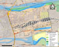
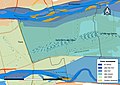 37233-Saint-Pierre-des-Corps-Zone inondable.jpg 3,507 × 2,480; 640 KB
-
 37273-La Ville-aux-Dames-argile.png 3,057 × 2,480; 3.22 MB
-
 37273-La Ville-aux-Dames-Cours eau.jpg 3,507 × 2,480; 642 KB
-
 37273-La Ville-aux-Dames-Sols.png 3,270 × 2,598; 3.28 MB
-
 Candes-Saint-Martin antique.svg 627 × 527; 42 KB
-
 Candes-Saint-Martin Cassini.jpg 496 × 375; 59 KB
-
 Candes-Saint-Martin géologie.svg 630 × 515; 31 KB
-
 Candes-Saint-Martin Limite communale.jpg 953 × 578; 160 KB
-
 Candes-Saint-Martin médiéval.svg 1,112 × 884; 29 KB
-
 Candes-Saint-Martin N2000 habitat.svg 627 × 527; 26 KB
-
 Candes-Saint-Martin N2000 oiseaux.svg 627 × 527; 26 KB
-
 Candes-Saint-Martin N2000 vallée Vienne.svg 627 × 527; 25 KB
-
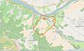
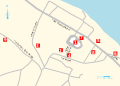
 Candes-Saint-Martin OSM 01.png 617 × 546; 164 KB
-
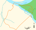
 Candes-Saint-Martin OSM 02.png 617 × 545; 272 KB
-
 Candes-Saint-Martin plan MH.svg 1,234 × 884; 31 KB
-
 Candes-Saint-Martin ZNIEFF bocage Véron.svg 627 × 527; 25 KB
-
 Candes-Saint-Martin ZNIEFF Boiret.svg 627 × 527; 25 KB
-
 Candes-Saint-Martin ZNIEFF Loire tourangelle.svg 627 × 527; 26 KB
-
 La Ville-aux-Dames Limite communale.jpg 957 × 576; 221 KB
-
 La Ville-aux-Dames voies antiques.svg 925 × 1,325; 339 KB
-
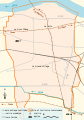
 Map commune FR insee code 37003.png 756 × 605; 76 KB
-
 Map commune FR insee code 37011.png 756 × 605; 51 KB
-
 Map commune FR insee code 37025.png 756 × 605; 63 KB
-
 Map commune FR insee code 37042.png 756 × 605; 46 KB
-
 Map commune FR insee code 37074.png 756 × 605; 69 KB
-
 Map commune FR insee code 37077.png 756 × 605; 64 KB
-
 Map commune FR insee code 37102.png 756 × 605; 29 KB
-
 Map commune FR insee code 37118.png 756 × 605; 72 KB
-
 Map commune FR insee code 37123.png 756 × 605; 93 KB
-
 Map commune FR insee code 37131.png 756 × 605; 76 KB
-
 Map commune FR insee code 37138.png 756 × 605; 38 KB
-
 Map commune FR insee code 37156.png 756 × 605; 88 KB
-
 Map commune FR insee code 37161.png 756 × 605; 53 KB
-
 Map commune FR insee code 37163.png 756 × 605; 74 KB
-
 Map commune FR insee code 37171.png 756 × 605; 57 KB
-
 Map commune FR insee code 37185.png 756 × 605; 65 KB
-
 Map commune FR insee code 37233.png 756 × 605; 70 KB
-
 Map commune FR insee code 37273.png 756 × 605; 66 KB
-
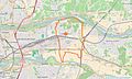
 Montlouis-sur-Loire OSM 01.png 1,540 × 820; 846 KB
-
 Montlouis-sur-Loire OSM 02.png 1,540 × 820; 1.21 MB
-
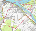
 Saint-Pierre-des-Corps OSM 01.png 927 × 763; 557 KB
-
 Saint-Pierre-des-Corps OSM 02.png 927 × 763; 843 KB


