
Category:Maps of Linz
Wikimedia category | |||||
| Upload media | |||||
| Instance of | |||||
|---|---|---|---|---|---|
| Category combines topics | |||||
| Linz | |||||
capital city of Upper Austria, Austria     | |||||
| Instance of |
| ||||
| Patron saint | |||||
| Location |
| ||||
| Head of government | |||||
| Population |
| ||||
| Area |
| ||||
| Elevation above sea level |
| ||||
| Different from | |||||
| official website | |||||
 | |||||
Subcategories
This category has the following 2 subcategories, out of 2 total.
O
P
Media in category "Maps of Linz"
The following 48 files are in this category, out of 48 total.
-
 Karte Aut Ooe L.png 300 × 265; 5 KB
-
 05 FallenFruit PublicFruitMap ArsElectronica.jpg 707 × 1,000; 269 KB
-
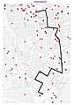
 2021-09-09 Bulgariplatz Lage.jpg 1,346 × 724; 180 KB
-
 20230929 WikiCon Photowalk.jpg 559 × 793; 243 KB
-
 A26 LinzerAutobahn Screenshot.png 1,319 × 1,219; 2.28 MB
-
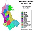 Bezirke Linz 2017.jpg 2,350 × 2,120; 521 KB
-
 Gerichtsbezirk Linz.svg 363 × 341; 298 KB
-
 Gerichtsbezirke Linz (1923).svg 363 × 341; 484 KB
-
 Karte Statistische Bezirke von Linz 2019.svg 882 × 1,166; 9.12 MB
-
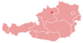 Karte Österreich Linz.png 299 × 154; 14 KB
-
 Kastell Lentia Grabungsübersicht.png 2,126 × 4,084; 6.68 MB
-
 Linz Bezirke 2014 Bindermichl-Keferfeld.jpg 600 × 822; 228 KB
-
 Linz Bezirke 2014 Bulgariplatz.jpg 600 × 822; 224 KB
-
 Linz Bezirke 2014 Dornach-Auhof.jpg 600 × 822; 221 KB
-
 Linz Bezirke 2014 Ebelsberg.jpg 600 × 822; 217 KB
-
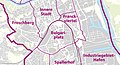
 Linz Bezirke 2014 Franckviertel.jpg 600 × 822; 228 KB
-
 Linz Bezirke 2014 Froschberg.jpg 600 × 822; 228 KB
-
 Linz Bezirke 2014 Industriegebiet-Hafen.jpg 600 × 822; 216 KB
-
 Linz Bezirke 2014 Innere Stadt.jpg 600 × 822; 225 KB
-
 Linz Bezirke 2014 Kaplanhof.jpg 600 × 822; 224 KB
-
 Linz Bezirke 2014 Kleinmuenchen-Auwiesen.jpg 600 × 822; 221 KB
-
 Linz Bezirke 2014 Neue Heimat.jpg 600 × 822; 252 KB
-
 Linz Bezirke 2014 Pichling.jpg 600 × 822; 218 KB
-
 Linz Bezirke 2014 Poestlingberg.jpg 600 × 822; 226 KB
-
 Linz Bezirke 2014 Spallerhof.jpg 600 × 822; 226 KB
-
 Linz Bezirke 2014 St. Magdalena.jpg 600 × 822; 225 KB
-
 Linz Bezirke 2014 Urfahr.jpg 600 × 822; 223 KB
-
 Linz bezirke altstadtviertel.jpg 454 × 537; 88 KB
-
 Linz bezirke ebelsberg.jpg 454 × 537; 46 KB
-
 Linz bezirke innenstadt nummern.jpg 454 × 537; 106 KB
-
 Linz bezirke innenstadt.jpg 454 × 537; 88 KB
-
 Linz bezirke kleinmünchen.jpg 454 × 537; 45 KB
-
 Linz bezirke lustenau.jpg 454 × 537; 92 KB
-
 Linz bezirke neustadtviertel.jpg 454 × 537; 88 KB
-
 Linz bezirke poestlingberg.jpg 454 × 537; 89 KB
-
 Linz bezirke rathausviertel.jpg 454 × 537; 88 KB
-
 Linz bezirke stmagdalena.jpg 454 × 537; 93 KB
-
 Linz bezirke stpeter.jpg 454 × 537; 91 KB
-
 Linz bezirke urfahr.jpg 454 × 537; 44 KB
-
 Linz bezirke volksgartenviertel.jpg 454 × 537; 88 KB
-
 Linz bezirke waldegg nummern.jpg 454 × 537; 106 KB
-
 Linz bezirke waldegg.jpg 454 × 537; 88 KB
-
 Linz location map.png 924 × 1,310; 2.32 MB
-
 Linz und Nachbarbezirke.PNG 300 × 265; 3 KB
-
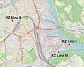 Map Konzentrationslager Linz.jpg 921 × 740; 329 KB
-
 Map Linz Voestalpine.jpg 921 × 740; 243 KB
-
 Musiktheater Linz.jpg 674 × 504; 156 KB
-
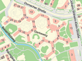 Stadtplan Linz Ausschnitt Biesenfeld.png 981 × 731; 437 KB


.svg)


