
Category:Maps of Lienden
Wikimedia category | |||||
| Upload media | |||||
| Instance of | |||||
|---|---|---|---|---|---|
| Category combines topics | |||||
| Lienden | |||||
village in Buren, Netherlands   .svg) | |||||
| Spoken text audio | |||||
| Instance of | |||||
| Location |
| ||||
| Population |
| ||||
| Area |
| ||||
| Different from | |||||
 | |||||
Media in category "Maps of Lienden"
The following 4 files are in this category, out of 4 total.
-
 Domaine de Lynden.png 2,434 × 1,517; 9.44 MB
-
 Ingen en Ommeren, Gemeenteatlas van Nederland.jpg 2,443 × 3,121; 8.76 MB
-
 Lienden, Gemeenteatlas van Nederland.jpg 3,051 × 2,302; 7.14 MB
-
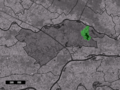 Map NL - Buren - Lienden.png 800 × 600; 288 KB


