Category:Maps of Le Touquet-Paris-Plage
Jump to navigation
Jump to search
Wikimedia category | |||||
| Upload media | |||||
| Instance of | |||||
|---|---|---|---|---|---|
| Category combines topics | |||||
| Le Touquet-Paris-Plage | |||||
French commune in Pas-de-Calais | |||||
| Instance of | |||||
| Location |
| ||||
| Head of government | |||||
| Population |
| ||||
| Area |
| ||||
| Elevation above sea level |
| ||||
| official website | |||||
 | |||||
Media in category "Maps of Le Touquet-Paris-Plage"
The following 24 files are in this category, out of 24 total.
-
62826-Le Touquet-Paris-Plage-Sols.png 3,270 × 2,598; 3.3 MB
-
Le Touquet-paris-Plage (carte détaillée - nord).png 672 × 619; 136 KB
-
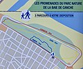
Le Touquet-Paris-Plage - promenades de la baie de Canche.jpg 2,256 × 1,881; 1.03 MB
-
Le Touquet-Paris-Plage.jpg 1,456 × 1,231; 495 KB
-
Localisation de la Communauté de Communes Mer et Terres d'Opale.png 650 × 604; 73 KB
-
Map commune FR insee code 62826.png 756 × 605; 55 KB
-
Plan de Paris-Plage fin XIXe siècle.jpg 1,308 × 1,054; 195 KB
-
62-Étaples - Le Touquet-Paris-Plage-AAV2020.png 3,519 × 2,930; 1,012 KB
-
62826-Le Touquet-Paris-Plage-Hydro.jpeg 5,846 × 4,133; 3.21 MB
-
62826-Le Touquet-Paris-Plage-ZNIEFF1.png 3,519 × 2,480; 5.68 MB
-
62826-Le Touquet-Paris-Plage-ZNIEFF2.png 3,519 × 2,480; 5.64 MB
-
Touquet berck osm.png 2,480 × 2,956; 810 KB
-
Le Touquet-paris-Plage (carte détaillée - centre).png 672 × 620; 201 KB
-
Le Touquet-paris-Plage (carte détaillée - sud).png 1,344 × 1,241; 605 KB
-
Le Touquet-paris-Plage (carte générale).png 673 × 620; 178 KB
-
Le Touquet-Paris-Plage - Promenades entre terre et mer.jpg 2,331 × 1,626; 1.21 MB
-
Le Touquet-Paris-Plage OSM 01.png 612 × 892; 906 KB
-
Le Touquet-Paris-Plage OSM 02.png 612 × 892; 951 KB
-
Le Touquet-Paris-Plage OSM 03.png 1,164 × 1,092; 1.45 MB


