Category:Maps of Lasclaveries
Jump to navigation
Jump to search
Wikimedia category | |||||
| Upload media | |||||
| Instance of | |||||
|---|---|---|---|---|---|
| Category combines topics | |||||
| Lasclaveries | |||||
commune in Pyrénées-Atlantiques, France  Церковь Успения Пресвятой Богородицы  | |||||
| Instance of | |||||
| Location | |||||
| Population |
| ||||
| Area |
| ||||
| Elevation above sea level |
| ||||
 | |||||
Media in category "Maps of Lasclaveries"
The following 5 files are in this category, out of 5 total.
-
 64321-Lasclaveries-argile.jpg 3,057 × 2,480; 461 KB
-
 64321-Lasclaveries-Sols.png 3,270 × 2,598; 1.78 MB
-
 64321-Lasclaveries-ZNIEFF1.png 3,057 × 2,480; 3.33 MB
-
 64321-Lasclaveries-ZNIEFF2.png 5,866 × 4,133; 5.07 MB
-
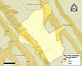
 Map commune FR insee code 64321.png 756 × 605; 37 KB


