Category:Maps of Lake Turkana
Jump to navigation
Jump to search
Wikimedia category | |||||
| Upload media | |||||
| Instance of | |||||
|---|---|---|---|---|---|
| Category combines topics | |||||
| Lake Turkana | |||||
alkaline lake on the border of Ethiopia and Kenya | |||||
| Instance of | |||||
| Part of | |||||
| Location |
| ||||
| IUCN protected areas category | |||||
| Width |
| ||||
| Length |
| ||||
| Area |
| ||||
| Elevation above sea level |
| ||||
| Inflows |
| ||||
| Outflows | |||||
| Different from | |||||
 | |||||
Media in category "Maps of Lake Turkana"
The following 19 files are in this category, out of 19 total.
-
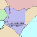
LocMap of WH Lake Turkana NP.png 275 × 275; 2 KB
-
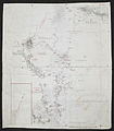
'Incomplete Drawing by R.G.S.' - War Office ledger (WOOS-7-2).jpg 5,996 × 8,799; 23.5 MB
-
'Photograph of (c) with additions by R.G.S.' - War Office ledger (WOOS-7-3).jpg 6,491 × 7,442; 21.25 MB
-
Keriofloden.png 598 × 830; 107 KB
-
Lac Turkana.png 664 × 628; 58 KB
-
Lake Turkana vicinity.jpg 1,543 × 1,165; 838 KB
-
Northern Frontier. Archers Post - Marsabit - Lake Rudolf. (WOMAT-AFR-BEA-312).jpg 9,015 × 8,726; 53.01 MB
-
Plane Table Sketch (WOMAT-AFR-BEA-268).jpg 6,077 × 8,880; 34.33 MB
-
South West Rudolf. (WOMAT-AFR-BEA-298).jpg 7,271 × 6,555; 29.36 MB
-
Turkana outline.gif 23 × 37; 1 KB
-
Turkanasee Kopie.jpg 202 × 466; 34 KB
-
Turkanasjön läge.png 977 × 1,171; 135 KB
-
Uganda Made with 6 inch compass from known points (WOMAT-AFR-BEA-126-1).jpg 6,437 × 8,618; 29.87 MB
-
Uganda Made with 6 inch compass from known points (WOMAT-AFR-BEA-126-2).jpg 6,382 × 8,534; 28.03 MB


