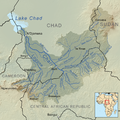
Category:Maps of Lake Chad Drainage basin
Jump to navigation
Jump to search
Media in category "Maps of Lake Chad Drainage basin"
The following 23 files are in this category, out of 23 total.
-
1911French Congo.png 1,348 × 1,360; 1.98 MB
-
Abfluss Megatschad.jpg 451 × 179; 31 KB
-
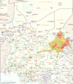
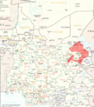
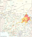
Boko Haram in Lake Chad Region.png 3,075 × 3,500; 5.45 MB
-
Boko Haram in Lake Tchad Region.png 3,075 × 3,500; 4.47 MB
-
Boko Haram Insurgency in Lake Chad Region (Feb. 11, 2015).png 3,075 × 3,500; 4.49 MB
-
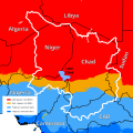
Chad Klima.svg 833 × 833; 371 KB
-
Chad River Basin relief 2.png 2,212 × 2,131; 1.23 MB
-
Chad River Basin relief.svg 531 × 511; 130 KB
-
Charirivermap.png 1,001 × 1,000; 1.46 MB
-
Eastern Sahel in Politische Wandkarte von Africa im Maßstabe by Heinrich Kiepert.jpg 4,669 × 2,399; 9.71 MB
-
Lake Chad OSM.png 593 × 575; 298 KB
-
Lake Chad region in 1890 - Bagirmi highlighted.svg 408 × 242; 316 KB
-
NE Nigeria states and rivers.png 800 × 428; 97 KB
-
OSM-LeChari.png 974 × 709; 356 KB
-
Slope of Logone river.png 1,280 × 720; 88 KB
-
Slope of Vina North.png 1,280 × 720; 74 KB
-
Wadai region around 1890.svg 378 × 400; 484 KB
-
Yobe Basin Koeppen.svg 567 × 390; 1.24 MB
-
Yobe Basin OSM.svg 567 × 354; 2.76 MB
-
Yobe river catchment area-es.svg 3,056 × 1,984; 542 KB
-
Yobe river catchment area-pt.svg 3,056 × 1,984; 165 KB
-
Yobe river catchment area.png 938 × 609; 66 KB

