Category:Maps of Lagos (Nigeria)
Jump to navigation
Jump to search
Subcategories
This category has only the following subcategory.
L
Media in category "Maps of Lagos (Nigeria)"
The following 16 files are in this category, out of 16 total.
-
1898 Lagos Nigeria map byJohnston BostonPublicLibrary m0612007.png 1,190 × 611; 1.39 MB
-
1898 Niger map byJohnston BPL m0612007.png 545 × 749; 714 KB
-
1962 Lagos Island map detail Lagos Nigeria txu-oclc-441966035-lagos-1962.jpg 1,908 × 1,466; 2.66 MB
-
1962 Lagos Island map detail2 Lagos Nigeria txu-oclc-441966035-lagos-1962.jpg 5,725 × 2,058; 13.73 MB
-
1962 Lagos Mainland map detail Lagos Nigeria txu-oclc-441966035-lagos-1962.jpg 3,351 × 4,129; 18.5 MB
-
1962 map detail Lagos Nigeria txu-oclc-441966035-lagos-1962.jpg 2,002 × 2,853; 8.29 MB
-
1962 map Lagos Nigeria Txu-oclc-441966035-lagos-1962.jpg 6,331 × 7,430; 12.02 MB
-
Admiralty Chart No 2812 Lagos Harbour, Published 1929.jpg 11,103 × 16,258; 43.19 MB
-
Ecobank global presence 2011.png 1,746 × 1,998; 336 KB
-
Jimbo Lagos Nigeria.png 567 × 562; 175 KB
-
Lagos Map.PNG 410 × 330; 54 KB
-
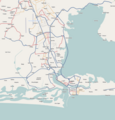
Lagos Terminus (OpenStreetMap).png 940 × 610; 120 KB
-
Lekki Masterplan showing Gracefield Island.jpg 544 × 384; 45 KB
-
Location map Nigeria Lagos.png 903 × 946; 245 KB
-
Map of the Local Government Areas of Lagos.png 898 × 473; 105 KB
-
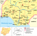
Nigeria-karte-politisch-lagos.png 567 × 562; 189 KB


