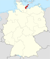
Category:Maps of Kreis Ostholstein
Jump to navigation
Jump to search
Districts of Schleswig-Holstein:
Urban districts (cities):
| NO WIKIDATA ID FOUND! Search for Maps of Kreis Ostholstein on Wikidata | |
| Upload media |
Subcategories
This category has the following 4 subcategories, out of 4 total.
Media in category "Maps of Kreis Ostholstein"
The following 2 files are in this category, out of 2 total.
-
Locator map OH in Germany.svg 1,075 × 1,273; 501 KB
-
Locator map OH in Schleswig-Holstein.svg 967 × 774; 212 KB

