Category:Maps of Kozhikode district
Jump to navigation
Jump to search
Wikimedia category | |||||
| Upload media | |||||
| Instance of | |||||
|---|---|---|---|---|---|
| Category combines topics | |||||
| Kozhikode district | |||||
district of Kerala, India | |||||
| Instance of | |||||
| Location | Kerala, India | ||||
| Capital | |||||
| Inception |
| ||||
| Population |
| ||||
| Area |
| ||||
| Elevation above sea level |
| ||||
| Replaces |
| ||||
| Different from | |||||
| official website | |||||
 | |||||
Subcategories
This category has the following 2 subcategories, out of 2 total.
Media in category "Maps of Kozhikode district"
The following 25 files are in this category, out of 25 total.
-
04-kozhikod.png 692 × 1,038; 121 KB
-
04-kozhikod.svg 744 × 1,052; 48 KB
-
11. Map.jpg 2,831 × 2,331; 3.14 MB
-
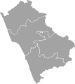
BlankMapKozhikodeSubdistricts.svg 447 × 500; 46 KB
-
Chaliyar map.PNG 720 × 441; 166 KB
-
Cheruvannur GP Location.png 1,024 × 768; 286 KB
-
India Kerala Kozhikode district.svg 874 × 1,274; 539 KB
-
Karipala, Nanminda, Kozhikode.png 2,374 × 2,362; 555 KB
-
Kozhikode district in 1961.svg 792 × 1,135; 1.43 MB
-
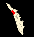
Kozhikode district location map.svg 700 × 766; 1.72 MB
-
Kozhikode district, Kerala.png 914 × 1,415; 73 KB
-
Kozhikode district.png 2,000 × 2,428; 827 KB
-
Kozhikode-district-map-en.png 2,000 × 2,953; 1.27 MB
-
Kozhikode-district-map-en.svg 2,010 × 2,968; 4.14 MB
-
Kozhikode-district-map-ml.png 2,000 × 2,953; 1.14 MB
-
Kozhikode-district-map-ml.svg 2,010 × 2,968; 4.32 MB
-
Kozhikode.png 7,015 × 9,933; 13.75 MB
-
Locator map of Kozhikode District.png 253 × 275; 129 KB
-
Malabar District (1951 Census).svg 1,164 × 1,655; 3.24 MB
-
Map of Malaparamba.png 1,318 × 730; 366 KB
-
Map of Samoothiris kingdom.jpg 2,400 × 3,000; 700 KB
-
Map-kozhikode.svg 728 × 928; 77 KB
-
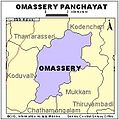
Omassery panchayath map.jpg 324 × 326; 26 KB
-
Subdistricts of Kozhikode (August 2020).svg 713 × 530; 942 KB
-
Subdistricts of Kozhikode.png 588 × 666; 50 KB


