Category:Maps of Kilimanjaro
Jump to navigation
Jump to search
Wikimedia category | |||||
| Upload media | |||||
| Instance of | |||||
|---|---|---|---|---|---|
| Category combines topics | |||||
| Mount Kilimanjaro | |||||
mountain massif in Kilimanjaro National Park in Tanzania | |||||
| Instance of | |||||
| Part of |
| ||||
| Made from material | |||||
| Located in protected area | |||||
| Location | Kilimanjaro Region, Tanzania | ||||
| Mountain range |
| ||||
| Topographic prominence |
| ||||
| Topographic isolation |
| ||||
| Highest point | |||||
| Elevation above sea level |
| ||||
| Different from | |||||
 | |||||
Subcategories
This category has the following 3 subcategories, out of 3 total.
G
V
Media in category "Maps of Kilimanjaro"
The following 31 files are in this category, out of 31 total.
-
Carte Kilimanjaro.jpg 400 × 485; 30 KB
-
Kilimanjaro and Arusha National Parks map-es.svg 2,242 × 1,621; 1.6 MB
-
Kilimanjaro and Arusha National Parks map-fr.jpg 3,363 × 2,431; 1.65 MB
-
Kilimanjaro and Arusha National Parks map-fr.svg 2,242 × 1,621; 1.6 MB
-
Kilimanjaro dymamics 2.jpg 834 × 1,169; 236 KB
-
Kilimanjaro dymamics2.jpg 834 × 1,169; 233 KB
-
Kilimanjaro Glaciers.jpg 518 × 397; 79 KB
-
Kilimanjaro map.gif 525 × 321; 7 KB
-
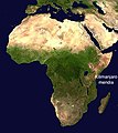
Kilimanjaro mendia.jpg 340 × 382; 27 KB
-
Kilimanjaro People.png 1,152 × 816; 109 KB
-
Kilimanjaro ppl.png 885 × 810; 121 KB
-
Map of Kilimanjaro Region showing all districts.gif 257 × 249; 4 KB
-
Mount Kilimanjaro and Mount Meru map-es.svg 2,242 × 1,888; 1.68 MB
-
Mount Kilimanjaro and Mount Meru map-fr.jpg 3,362 × 2,830; 2.11 MB
-
Mount Kilimanjaro and Mount Meru map-fr.svg 2,242 × 1,888; 1.68 MB
-
Mount Kilimanjaro and Mount Meru map-nl.svg 2,242 × 1,888; 1.69 MB
-
Mount Kilimanjaro Climbing Routes and Huts photomap-es.svg 1,561 × 1,083; 1.35 MB
-
Mount Kilimanjaro Climbing Routes and Huts photomap-fr.jpg 1,564 × 1,083; 746 KB
-
Mount Kilimanjaro Climbing Routes and Huts photomap-fr.svg 1,561 × 1,083; 1.36 MB
-
Mount Kilimanjaro Climbing Routes and Huts photomap-nl.svg 1,561 × 1,083; 1.36 MB
-
Mount Kilimanjaro Ethnic Groups map-es.svg 2,050 × 1,907; 790 KB
-
Mount Kilimanjaro Ethnic Groups map-fr.svg 2,050 × 1,907; 794 KB
-
Mount Kilimanjaro Ethnic Groups map-nl.svg 2,050 × 1,907; 804 KB
-
Mount Kilimanjaro Peoples map-fr.jpg 2,050 × 1,907; 907 KB
-
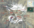
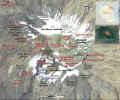
Mount Kilimanjaro Summit photomap-en.svg 806 × 669; 414 KB
-
Mount Kilimanjaro Summit photomap-es.svg 806 × 669; 415 KB
-
Mount Kilimanjaro Summit photomap-fr.svg 806 × 669; 414 KB
-
Mount Kilimanjaro Summit photomap-he.svg 806 × 669; 423 KB
-
Mount Kilimanjaro Summit photomap-nl.svg 806 × 669; 420 KB
-
ReliefKilimanjaro.png 1,095 × 634; 972 KB
-
Sheet 8 Kilimanjaro to Tsavo Stn. U.R.. (WOOS-8-5).jpg 8,646 × 6,402; 37.5 MB


