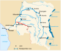
Category:Maps of Kasai River
Jump to navigation
Jump to search
Media in category "Maps of Kasai River"
The following 11 files are in this category, out of 11 total.
-
Angola-DRC boundary. LOC 84692090.jpg 5,721 × 4,136; 2.34 MB
-
Charleville - Makumbi (1926 - 1955) (1231382).jpg 486 × 629; 29 KB
-
Kasai jõgi.svg 671 × 559; 124 KB
-
Kasai River Catchment OSM.png 1,577 × 1,892; 5.12 MB
-
Kasai River Course.png 1,136 × 1,084; 221 KB
-
Kasai River DRC nl.svg 671 × 559; 368 KB
-
Kasai River DRC.svg 671 × 559; 124 KB
-
Kasai watershed.png 1,190 × 889; 878 KB
-
Originalkarte der Itinerar-Aufnahmen & Erkundigungen des Prem. Lieutt Curt von François.png 4,525 × 3,813; 21.93 MB


