Category:Maps of Kėdainiai District Municipality
Jump to navigation
Jump to search
Subcategories
This category has the following 3 subcategories, out of 3 total.
K
- Kėdainiai in maps (5 F)
M
- Maps of Kėdainiai (2 F)
Media in category "Maps of Kėdainiai District Municipality"
The following 10 files are in this category, out of 10 total.
-
 Ked teritorijos.png 444 × 397; 78 KB
-
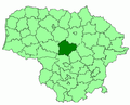 Kedainiai district location.png 623 × 503; 20 KB
-
 Kedainiai district location.svg 1,095 × 821; 116 KB
-
 Kedainiai dst.svg 1,000 × 800; 717 KB
-
 Kedainiai in Lithuania.svg 1,095 × 821; 524 KB
-
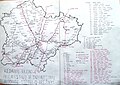
 Kedainiu rajono zemelapis.png 1,071 × 956; 212 KB
-
 KedainiuRajonoSeniunijos.png 883 × 721; 428 KB
-
 Kėdainių autobusų stotelės.JPG 4,024 × 2,860; 5.24 MB
-
 Kėdainių rajono savivaldybė.svg 1,006 × 898; 68 KB
-
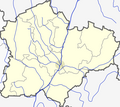
 KėdainiųRajPlikasZemelapis.png 539 × 480; 101 KB


