Category:Maps of Jean Lafitte National Historical Park and Preserve
Jump to navigation
Jump to search
English: Maps of Jean Lafitte National Historical Park and Preserve
Wikimedia category | |||||
| Upload media | |||||
| Instance of | |||||
|---|---|---|---|---|---|
| Category combines topics | |||||
| Jean Lafitte National Historical Park and Preserve | |||||
national Historical Park of the United States | |||||
| Instance of | |||||
| Location | Louisiana | ||||
| Operator | |||||
| IUCN protected areas category | |||||
| Inception |
| ||||
| Visitors per year |
| ||||
| official website | |||||
 | |||||
Media in category "Maps of Jean Lafitte National Historical Park and Preserve"
The following 16 files are in this category, out of 16 total.
-
NPS chalmette-battlefield-map.jpg 1,630 × 1,477; 277 KB
-
NPS chalmette-battlefield-map.pdf 1,287 × 1,166; 821 KB
-
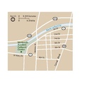
NPS jean-lafitte-acadian-cultural-center-map.gif 893 × 1,127; 55 KB
-
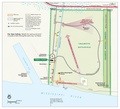
NPS jean-lafitte-barataria-preserve-trail-map.jpg 1,293 × 2,174; 246 KB
-
NPS jean-lafitte-map.jpg 3,683 × 2,522; 1.72 MB
-
NPS jean-lafitte-map.pdf 2,631 × 1,802; 5.5 MB
-
NPS jean-lafitte-new-orleans-area-map.gif 1,138 × 1,506; 160 KB
-
NPS jean-lafitte-new-orleans-area-map.pdf 447 × 593; 130 KB
-
NPS jean-lafitte-new-orleans-french-quarter-map.gif 1,215 × 906; 137 KB
-
NPS jean-lafitte-new-orleans-french-quarter-map.pdf 587 × 437; 213 KB
-
NPS jean-lafitte-regional-map.jpg 2,170 × 829; 260 KB
-
NPS jean-lafitte-regional-map.pdf 739 × 281; 510 KB
-
NPS prairie-acadian-cultural-center-map.gif 692 × 932; 28 KB
-
NPS prairie-acadian-cultural-center-map.pdf 235 × 316; 57 KB
-
NPS wetlands-acadian-cultural-center-map.gif 870 × 786; 49 KB
-
NPS wetlands-acadian-cultural-center-map.pdf 341 × 308; 63 KB


