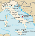
Category:Maps of Isole Tremiti
Jump to navigation
Jump to search
Media in category "Maps of Isole Tremiti"
The following 19 files are in this category, out of 19 total.
-
Map of comune of Isole Tremiti (province of Foggia, region Apulia, Italy).svg 7,356 × 9,244; 174 KB
-
Isoletremitiposizione.png 450 × 461; 218 KB
-
Italy - Tremiti.PNG 593 × 524; 140 KB
-
Posizionecapraia.png 1,311 × 1,252; 45 KB
-
Posizionecretaccio.png 1,311 × 1,252; 45 KB
-
Posizionepianosa.png 1,311 × 1,252; 45 KB
-
Posizionesandomino.png 1,311 × 1,252; 45 KB
-
Posizionesannicola.png 1,311 × 1,252; 45 KB
-
Tremiti - Zuallart Jean - 1587.jpg 1,487 × 1,100; 850 KB
-
Map of Tremiti islands - Cootwijck Johannes Van - 1619.jpg 1,500 × 1,027; 732 KB
-
"Insulae Tremitabae, olim Diomedeae dicta" (22264474131).jpg 3,744 × 2,916; 1.63 MB
-
Admiralty Chart No 1492 Ports on the East Coast of Italy, Published 1963.jpg 16,188 × 11,055; 35.36 MB
-
Admiralty Chart No 199 Brindisi to Ortona, Published 1881.jpg 16,257 × 11,118; 37.34 MB
-
Atlas Van der Hagen-KW1049B12 082-INSULAE TREMITANAE, olim DIOMEDEAE dictae.jpeg 5,500 × 4,267; 2.79 MB
-
Caprara.png 752 × 672; 263 KB
-
Cretaccio Ilhas Tremiti.png 724 × 672; 57 KB
-
Cretaccio.png 756 × 595; 113 KB
-
Gargano zone.jpg 642 × 828; 74 KB
-
Map of the gulf of Venice - Roux Joseph - 1804.jpg 1,500 × 1,029; 704 KB


