Category:Maps of Iron Age Britain
Jump to navigation
Jump to search
Wikimedia category | |||||
| Upload media | |||||
| Instance of | |||||
|---|---|---|---|---|---|
| Category combines topics | |||||
| British Iron Age | |||||
archaeology of Great Britain, referring to the prehistoric and protohistoric phases of the Iron Age | |||||
| Instance of | |||||
| Facet of | |||||
| Start time |
| ||||
| End time |
| ||||
| |||||
Media in category "Maps of Iron Age Britain"
The following 32 files are in this category, out of 32 total.
-
Brigantes.png 260 × 290; 3 KB
-
Britain 500 CE.png 1,149 × 829; 731 KB
-
Britonia6hcentury-ar.jpg 1,670 × 2,928; 375 KB
-
Britonia6hcentury.png 1,670 × 2,928; 542 KB
-
Caereni. cb.jpg 177 × 284; 11 KB
-
Carvetii.png 260 × 290; 9 KB
-
Coritani.png 237 × 266; 12 KB
-
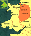
Cornovii.png 255 × 293; 33 KB
-
England Celtic tribes - North and Midlands.png 296 × 495; 27 KB
-
England Celtic tribes - South-he.png 550 × 297; 77 KB
-
England Celtic tribes - South.png 550 × 297; 96 KB
-
Map - Peoples of Britain and Ireland 100BCE.JPG 1,023 × 1,487; 131 KB
-
Map - Peoples of Britain and Ireland 100BCE.PNG 1,023 × 1,487; 82 KB
-
Map - Peoples of Britain and Ireland 15BCE.PNG 1,023 × 1,487; 86 KB
-
Map - Peoples of Britain and Ireland 15CE.PNG 1,023 × 1,487; 85 KB
-
Map - Peoples of Britain and Ireland 1CE.PNG 1,023 × 1,487; 86 KB
-
Map - Peoples of Britain and Ireland 20BCE.PNG 1,023 × 1,487; 85 KB
-
Map - Peoples of Britain and Ireland 25CE.PNG 1,023 × 1,487; 86 KB
-
Map - Peoples of Britain and Ireland 30BCE.PNG 1,023 × 1,487; 87 KB
-
Map - Peoples of Britain and Ireland 40CE.PNG 1,023 × 1,487; 85 KB
-
Map - Peoples of Britain and Ireland 50BCE.PNG 1,023 × 1,487; 82 KB
-
Map - Peoples of Britain and Ireland 7BCE.PNG 1,023 × 1,487; 85 KB
-
Map Gaels Brythons Picts patterns.png 778 × 829; 75 KB
-
Map Gaels Brythons Picts.png 643 × 829; 66 KB
-
Map of the Territory of the Atrebates.svg 744 × 1,052; 152 KB
-
Map of the Territory of the Brigantes.svg 744 × 1,052; 149 KB
-
Map of the Territory of the Cantiaci.svg 744 × 1,052; 151 KB
-
Map of the Territory of the Carvetii.svg 744 × 1,052; 149 KB
-
Map of the Territory of the Iceni.svg 744 × 1,052; 151 KB
-
Map of the Territory of the Parisii.svg 744 × 1,052; 148 KB
-
Parisii.png 221 × 256; 18 KB
-
South.Britain.Late.Iron.Age.jpg 3,142 × 3,020; 1,006 KB


